google8d2f7fffcdc71abe.html

Stepping across continents

About 10 miles west of the city of Yekaterinburg in Russia’s southern Ural Mountains, a roadside monument marks the official boundary between Asiatic and European Russia. Its location, in the middle of a pine forest on a level stretch of road, seems rather whimsical, but the sign states that scientists studied geological records and water flow patterns to confirm the spot. It officially replaced a marker erected in 1837 on top of a hill that for many years had been a popular destination for picnickers and newlyweds. It was close, but not close enough. The scientifically correct boundary point offers no views—except for trees, trees and trees—but first-time travelers rarely resist the temptation to stop and strike the obligatory photo pose, standing on the painted line marking the boundary, one foot in Asia and one in Europe. In this region of the southern Urals, there’s no perceptible difference between the two continents. From the road, in all directions, it is a landscape of hills, lakes, and forests of pine and white birch.

My colleague Lada Tikhonova and I straddle Asia and Europe at the continental divide marker in Russia’s southern Ural Mountains

My colleague Lada Tikhonova and I straddle Asia and Europe at the continental divide marker in Russia’s southern Ural Mountains

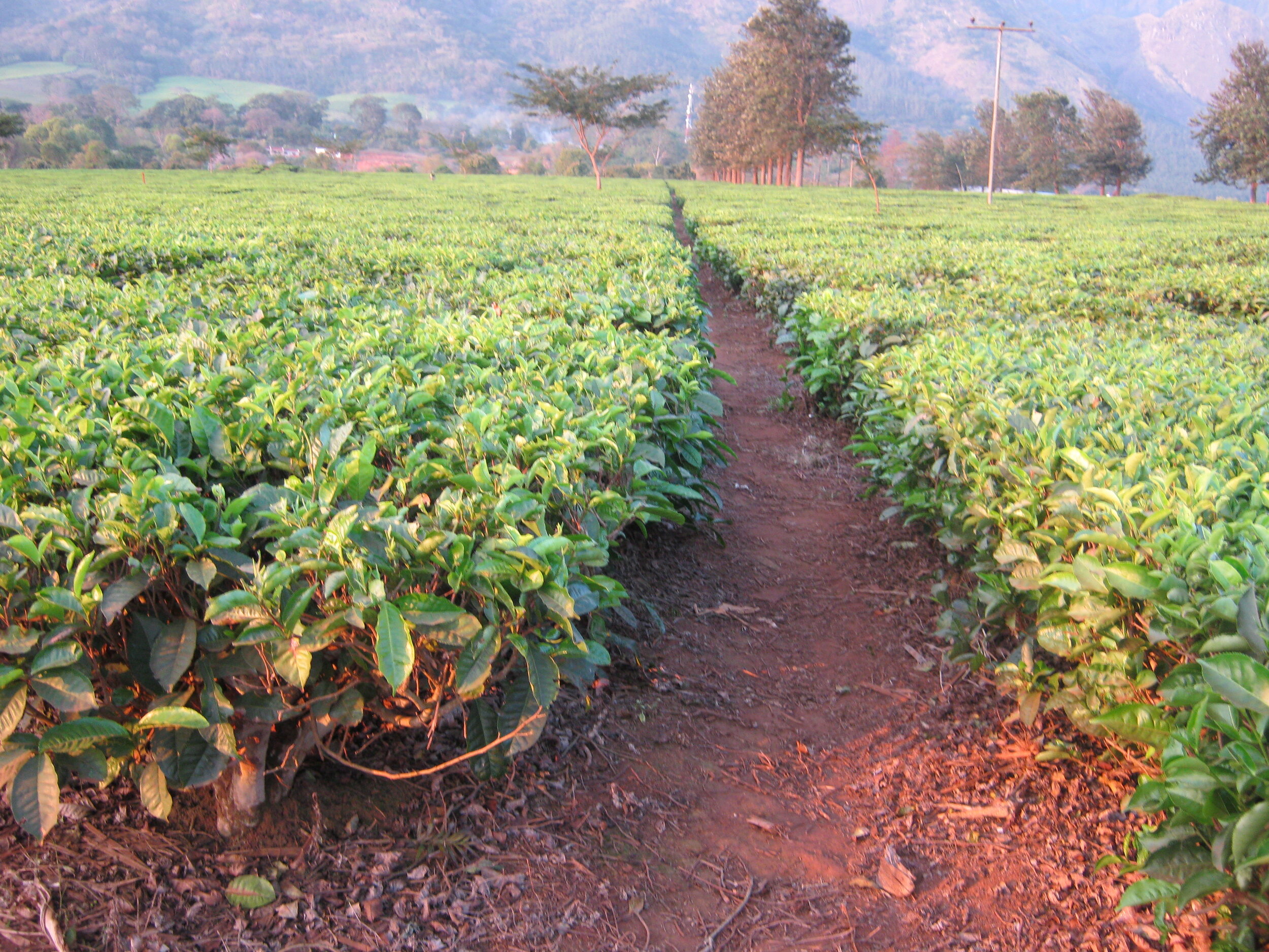
Russia is not only the largest country by land area in the world, but the only one that is dramatically transcontinental. Almost three quarters of its land area is in Asia: at 5.1 million square miles, it’s almost the size of the continent of Antarctica.  European Russia is the largest country in the continent, a little less than half the size of the continental United States. The population distribution is almost exactly reversed, with almost three quarters of Russia’s 146 million people in Europe. East of the industrial region of the Urals, the urban population is concentrated in a line of cities in southern Siberia, most of them along the Trans-Siberian Railway and its branches. To the north are vast deciduous forests of birch and poplar, and further north, the taiga, the swampy coniferous forests of pine, spruce and larch. Then it’s the tundra and finally the Arctic Sea.

The Ural Mountains, whose watershed forms the dividing line between Asia and Europe, stretch 1,250 miles from the Kara Sea in the Arctic north to Kazakhstan in the south. As mountain ranges go, the Urals are in the minor leagues; the highest peak, Mount Narodnaya (People’s Mountain), barely clears 6,000 feet, and in places the Urals are no more than large hills. For centuries, the region was mostly hunting country and lightly populated. The first large-scale settlements came in the early 18th century during the reign of Peter the Great when vast mineral resources were discovered. By the 19th century, the region, with its seemingly endless reserves of coal, iron and copper, as well as gold and precious metals, was the industrial heart of the expanding Russian Empire, with half a dozen large manufacturing cities. In the Soviet era, the coal mines, steel mills, locomotive factories and munitions plants of the Southern Urals were vital to economic growth and military power; with the collapse of the Soviet Union in 1991, the region became part of Russia’s “Rust Belt.”

“On the Continental Divide in Russia’s Southern Urals” is Chapter Seventeen of Postcards from the Borderlands, to be published by Open Books in November. You can pre-order here. Here’s what readers who had a sneak preview are saying about it:

“David Mould has been almost everywhere, but it would be wrong to call him a tourist. He interacts with people, experiences their culture, learns their history, sees how they really live. I’m amazed at his ability to soak up the tiniest details and weave them into engaging stories. Let him take you on his latest adventure.” -Kamellia Smith, former reporter for Indonesia's national magazine TEMPO and Cincinnati's Enquirer Media

Preview of “On the Continental Divide in Russia’s Southern Urals”

On a six-week teaching assignment, I travel in Russia’s Southern Urals, crossing the continental divide between Asia and Europe and fulfilling my Doctor Zhivago fantasy on the Trans-Siberian Railway (or at least a part of it). In Yekaterinburg, established in the early 18th century as an industrial center for the Urals mining region, I slog through the spring mud and gawp at the conspicuous consumption of so-called “New Russians” who have grown wealthy since the fall of the Soviet Union. I visit the ostentatious Church of the Blood, built to commemorate the murder of Tsar Nicholas II and his family in the city in 1918 as the White Army advanced. I meet the staff of the city’s film archive and learn about their struggle to preserve historic feature films and documentaries. In European Russia, I travel to Perm, a rust-belt city that is still a major river port and provided inspiration to Boris Pasternak for locations in Doctor Zhivago. On the Asian side of the divide, I travel to the city of Tyumen, the historic gateway to Siberia, which has grown rich from the oil and gas boom and reminds me of a “cold Houston.” And is the older “student” in my class a spy?  My interpreter thinks so.

Facebook 3 cropped 1.jpg

At the crossroads of Europe and Asia

It’s a cliché, but tourism campaigns and business boosters keep using it: their city is at “the crossroads of Europe and Asia.” Some of the claims are pretty iffy, resting on carefully selected historical data and ignoring anything that does not fit the narrative. The strongest “crossroads” contender is, of course, Istanbul, which straddles the Bosphorus Strait between European and Asiatic Turkey. However, Georgia’s capital is a worthy rival.

Tbilisi is situated in the narrow winding valley of the Mtkvari River, which rises in northeastern Turkey (where it is called the Kura) and flows east through Georgia, its tributaries carrying snowmelt from the southern Caucasus, and entering the Caspian Sea in Azerbaijan. For centuries, Tbilisi was the head of navigation on the Mtkvari and an important river port. During the 20th century, extensive irrigation for agriculture and the building of reservoirs and hydro-electric plants substantially reduced water flow, halting commercial traffic. Today, the only boats on the Mtkvari in Tbilisi are those offering tourist excursions.

16.1 Tbilisi in the valley of the Mtkvari River.jpg

With the medieval fortress of Narikala on a hill overlooking the old town, and its narrow, twisting cobbled streets and stone churches, Tbilisi recalls Eastern European cities such as Prague or Budapest. Yet the Asian influence is evident in the architecture, with brightly-painted decorative wooden balconies on older houses, some of which were once caravanserais (inns).

Tbilisi was once a major trading center, where routes from Istanbul, Tehran, Baghdad, Damascus and other cities converged. It was a place to rest and stock up on supplies before the hazardous journey through the passes of the Caucasus or across the Caspian Sea to the cities of Southern Russia, or to the Silk Road routes through Central Asia.

The city was founded, probably in the 4th century, on the site of hot sulfur springs.  According to legend, a local king was out hunting when a pheasant fell into the spring and was conveniently cooked up for dinner. Tbilisi takes its name from the Georgian word tbili (warm). Over the centuries, the crossroads city has been conquered and liberated many times—by the Persians (three times), the Mongols, the Turks, and the Russians. In the last Persian invasion in 1795, thousands were killed and much of the city burned to the ground. The Russians rebuilt it in imperial style in the 19th century. In between invasions, the Georgians made it their capital.

Georgia has always been at the mercy of its larger and more powerful neighbors. The most recent conflict came in August 2008 when Russia invaded on the pretext of defending the rights of citizens in the breakaway regions of South Ossetia and Abkhazia. Thousands of ethnic Georgians were forced to flee their homes, although many returned later. Russia promptly declared the two regions independent republics; Georgia and most of the international community consider them to be Russian-occupied. With Vladimir Putin continuing to flex his military muscle with the annexation of Crimea and the conflict in eastern Ukraine, no one is placing bets on Georgia regaining its lost territory anytime soon.

“Tbilisi: Crossroads of Eurasia” is Chapter Sixteen of Postcards from the Borderlands, to be published by Open Books in November. You can pre-order here. Here’s what readers who had a sneak preview are saying about it:

“In Borderlands, Mould addresses questions we might never have thought to ask. When did mapping and delineation of borders begin? When, where and why were passports first used? How are borders felt and understood by the people who live near them? … As an experienced guide, he encourages us to shelve our worries, expand our mental borders and explore the unfamiliar. Ride in a rickshaw, try the frog porridge and get to know our fellow humans, wherever they live.” -Margaret Romoser, educator, community activist and avid traveler

Preview of “Tbilisi: Crossroads of Eurasia”

Of cities that claim to be the crossroads between Europe and Asia, Tbilisi, the capital of Georgia, has a pretty good claim. For centuries it was on the trade routes from Europe, Turkey and Iran across the Caucasus Mountain to southern Russia and the Caspian Sea, and the Silk Road to the east. Nestled in a narrow river valley, with cobbled streets and ancient churches, Tbilisi’s architecture mixes European and Asian styles. For three quarters of a century, Georgia was a republic in the Soviet Union, ruled for 30 years by its now-not-so-favorite son, Joseph Stalin. Since independence, it has been in conflict with Russia which invaded in 2008, annexing two areas of the South Caucasus. In Tbilisi, I work with the Georgian Institute of Public Affairs, meet its rector, a future president of the country, learn about its messy politics, and witness the impact of the Georgian Orthodox Church religion on the daily lives of its people. 

Facebook 3 cropped 1.jpg


The long and winding road from Osh to Jalalabad

As the crow flies, Kyrgyzstan’s second and third largest cities—Osh and Jalalabad—are just 30 miles apart, on the south and north sides of the Fergana Valley. The highway from Osh runs north 15 miles to a bustling border town, its bazaar a major distribution point for imported Chinese consumer goods. On the Kyrgyz side, it’s called Kara-Soo; on the Uzbek side Qorasuv (both mean Black Water). Cross the bridge and it’s a straight shot north past the industrial town of Khanabad before crossing back into Kyrgyzstan for the final few miles to Jalalabad.

It would be a simple trip if not for regional politics. For three quarters of a century, the internal boundaries of the Soviet Socialist Republics (SSRs) were marked on administrative maps but made little difference in the daily lives of people who crossed them freely—often daily—for work, school, shopping or to visit relatives. The only sign that you were crossing from one SSR to another might be a small commemorative welcome plaque or a police post.

It was only after the collapse of the Soviet Union in December 1991, when each SSR became an independent country, that the notional boundaries became national borders. Soviet citizens suddenly found themselves citizens of an independent country with gerrymandered borders drawn in the 1920s to divide and rule Central Asia’s ethnic groups. In border regions, nomadic families were no longer free to move their herds between winter and summer pastures; some arable farmers could not reach their wells or found their irrigation ditches cut. Buses stopped at the border and people could no longer travel easily to visit relatives or trade or shop on the market.

In the Fergana Valley, the borders cut through the middle of towns such as Qorasuv and villages, sometimes through the middle of houses. Although most of the valley is in Uzbekistan, the northern panhandle of Tajikistan (Sughd oblast, with a population of more than two million) juts into the valley, physically, economically, and culturally separated from the rest of the country by the Pamir Alay mountain range. Uzbekistan literally bisects southern Kyrgyzstan, the border zigzagging in and out of the foothills of the Fergana and the Pamir Alay.

The long way around from Osh to Jalalabad

The long way around from Osh to Jalalabad

At Kara-Soo, the Uzbek authorities destroyed the bridge, stifling the local economy. Local people, used to bureaucratic paranoia, improvised, using rope walkways to cross the stream. The bridge has since been rebuilt but the border is still tightly policed by Uzbek border guards, who claim they are trying to keep out arms, drugs, and Islamic terrorists. Even if you make it across, you may not reach Jalalabad because the border crossing back into Kyrgyzstan is periodically closed. Most drivers from Osh take a circuitous 65-mile, two-hour route via the Kyrgyz town of Uzgen. Osh and Jalalabad are separated by only a slim wedge of eastern Uzbekistan, but it’s faster to drive around it than face delays and fines at the border posts.

“Central Asia’s Fergana Valley: Border Wars” is Chapter Fifteen of Postcards from the Borderlands, to be published by Open Books in November. You can pre-order here. Here’s what readers who had a sneak preview are saying about it:

“Whether you are a confirmed armchair traveler, or someone considering the road less taken, David provides a primer that demystifies many countries and transcends borders, clearing the way for a better understanding of cultures beyond our comfort zone.” -Frederick Lewis, documentary filmmaker, Professor, Media Arts & Studies, Ohio University

Preview of “Central Asia’s Fergana Valley: Border Wars”

When the Soviet Union collapsed in 1991, its 15 Soviet Socialist Republics (SSRs) suddenly became nations, whether or not they wanted independence. Their borders had been drawn in the 1920s to prevent any ethnic group from dominating a region, and in an attempt to suppress Islamic and secessionist movements. In the Soviet era, the borders made little difference in peoples’ lives, but the new national borders divided communities and families and restricted travel and commerce. In the fertile Fergana Valley, the northern panhandle of Tajikistan juts into Uzbekistan. Southern Kyrgyzstan is literally bisected by Uzbekistan, tripling travel time between the cities of Osh and Jalalabad. Violent clashes between Kyrgyz and Uzbeks over land and political power broke out as the Soviet Union was dissolving, and again in 2010. The jagged borders include territorial enclaves, whose inhabitants face long journeys to reach their country’s mainland. Regional power struggles are played out over natural resources; Kyrgyzstan holds back water from mountain rivers that Uzbekistan needs to irrigate its cotton crop; in return, Uzbekistan cuts supplies of gas and electricity. Since the mid-1990s, I have traveled frequently in the Fergana Valley, negotiating its messy borders.

Facebook 3 cropped 1.jpg


Keep counting those yaks

If you’re looking for an outdoor job with lots of travel, some on horseback, and camping out under the stars, I have the career for you: become a data collector in rural Mongolia.

In land area, Mongolia is the 18th largest country in the world, about the size of Iran, or more than twice the size of  Texas. Yet its population of about 3.25 million puts it in the demographic minor league with countries such as Bosnia, Armenia, and Jamaica. Compared with US states, it has as many people as Utah or Iowa. Almost half of them live in the capital, Ulaanbaatar, commonly abbreviated as UB. Another half million live in smaller urban centres. That leaves almost one million who are technically classified as rural.

According to the World Bank, Mongolia has the lowest population density of any country in the world—an average of two people per square kilometer. The average does not mean much. At any time, but especially in winter, there are many square kilometers with no people at all, or just a herder family passing through. That’s because Mongolia has little land that can be cultivated. Three quarters of the land area is grassland steppe, suitable only for grazing. There are mountains to the north and west and, in the south, the vast Gobi Desert, searing hot in summer, bitterly cold in winter.

Those jokes about “more sheep than people” play well in rural Mongolia because livestock numbers have been steadily increasing. According to the national statistics office, which has been conducting livestock censuses since 1918, the country had a record high of 66.46 million animals in 2018. That’s about 20 animals for every person. Sheep (46 per cent) and goats (40.8 per cent), whose cashmere wool is the main source of income for herders, accounted for most of the total. There are smaller numbers of cattle, yaks, horses and camels. The increase sounds like good news for all concerned—herders, consumers and government tax collectors--but it comes with a long-term environmental cost as pasture lands in some regions are overgrazed.

Keep counting those yaks

Keep counting those yaks

In any case, you have to wonder about the accuracy of the census, conducted in a 10-day period in December when most of the country was covered in deep snow and travel was hazardous. Did the data collectors survey the herds and hope they didn’t count the same sheep twice? Did they show up at the family ger—the traditional felt tent—and ask the patriarch about the size and composition of his herd? Or did they stay at their computers in their offices in UB and wait for herders to self-report using the app on their mobile phones?

It’s a little like asking people how much property they own or how much they earned without requiring titles or pay slips; when tax time rolls around, it’s a natural human tendency to under-report. Around the campfire, drinking airag (fermented mare’s milk) or vodka, herders like to boast about their livestock; in rural Mongolia, social status is measured by the size of the herd. But when census time comes around, the herder knows the information will be shared with the tax authorities. He’s more likely to be modest about what he owns, or claim he lost livestock in the latest winter storm. What’s a data collector to do?  Ride out and look for dead sheep?  Bottom line: in 2018, there may have been more than 66.46 million livestock, and the animals-to-people ratio even greater. 

“Mongolia: Borders on the Steppe” is Chapter Fourteen of Postcards from the Borderlands, to be published by Open Books in November. You can pre-order here. Here’s what readers who had a sneak preview are saying about it:

In Postcards from the Borderlands, Mould takes us to the places where different peoples cross paths, compete for the same land, mix or clash; where different languages, ethnicities, cultures, religions, traditions or histories come together or come apart. The borderlands Mould takes the reader to are not where jetsetters go. Beyond the gated entrance of seaside resorts where the bikini clad models cavort and uniformed waiters bring piña-coladas on a tray, there are the towns where people live, or scratch a living. The farms, the fisheries, the unpaved streets, the old mosques or churches or temples, the town markets where women bring fruits from their orchards to sell, the schools where children study and dream of a better future. - Josep Rota, Professor Emeritus of Communication and Vice Provost Emeritus for International Studies, Ohio University

Preview of “Mongolia: Borders on the Steppe”

For centuries, Mongolia’s herders have used physical features to navigate the vast grasslands of the steppe and mark the borders of their summer and winter pastures. Since independence in 1991, overgrazing and harsh winters that have killed livestock have forced many to leave their pastures for the capital, Ulaanbaatar (UB), whose population has tripled. Most rural migrants  still live in the traditional ger, clusters of which form a tent city encircling UB’s dreary, Soviet-era apartment blocks. The economic boom is in mining, with coal shipped to Chinese power plants, and valuable deposits of copper and gold in the Gobi Desert. Mongolia, long a buffer state between the Soviet Union and China, still depends heavily on its larger, more powerful neighbors. From UB, with its ostentatious Soviet public buildings, war memorials and Irish pubs, I travel northeast to the Gorki Terelj National Park to dine with dinosaurs, walk through the woods at a rundown Soviet-era resort, and come up with a plan to keep a group of media managers entertained and reasonably sober.

Facebook 3 cropped 1.jpg


The metal detector and me

My workshop in Pakistan’s commercial capital, Karachi, was held at the Carlton Hotel, a few miles out of the city, in a large flat, sandy area reclaimed from the Arabian Sea. My hosts, the GEO television network, chose the Carlton because of its security precautions. At one time the hotel had four entrances; three had been closed and the remaining entrance had a guard post and barrier. Even after you entered, you could not drive all the way to the main entrance but had to park behind concrete barriers about 100 yards away. The entrance was manned by a uniformed security guard and a hotel staff member who, with his white tunic, maroon waistcoat and plumed hat, looked as if he’d stepped out of the palace guard for an 18th century Maharajah or off the set of a TV period drama.

I always approach metal detectors and scanners with trepidation. Surely, there’s something in my backpack or briefcase that will trigger an alarm or look suspicious. I am ready to spread out the contents, turn on my laptop and audio recorder, and explain why I’m carrying power adaptors and other accessories. I dutifully empty my pockets of coins and pens. After the first few here’s-what-I-have-that-you-may-want-to-check performances at the Carlton, I realized that the guards were simply not interested in what I was carrying, even if it triggered the alarm on the metal detector. All they did was smile and say, “Good evening, sir. I hope you are enjoying your stay at the Carlton.” It all seemed to me to be a problematic case of reverse ethnic profiling. Surely, white Western males in their 60s should be subject to the same scrutiny as everyone else.

Karachi has an unenviable, and today statistically undeserved, reputation as a dangerous city, ruled by gangs and terrorists, rife with corruption and street crime. Crime rates rose from the late 1980s, when Pashtuns fleeing the Soviet invasion of Afghanistan arrived, opening up channels for smuggling arms and drugs. In the 1990s, criminal mafias with political connections became powerful, controlling much of the commercial transport system, water tankers and the sand and gravel industries. After a 2013 crackdown by security forces, the number of murders, kidnappings and extortion crimes dropped dramatically, although street crime levels remain high. As a result of the operation, Karachi went from being ranked the world's sixth most dangerous city for crime in 2014 to 93rd by early 2020.

With the drop in crime rates, real estate prices have increased sharply, and more upmarket businesses have opened. One evening, my hosts took me to Zamzana, a street in an upscale district known for its wide range of restaurants. We were welcomed by a young man sporting Levis, a denim shirt, scarf, and cowboy hat. Welcome to Gun Smoke, where the old West comes alive in modern Karachi. The interior of the restaurant is lined with cowboy kitsch, including a few cattle skulls, and there’s country music on the sound system. The usual menu of buffalo wings, steaks, and burgers. Wild West popular culture travels well.

On the wild west side of Karachi—a poker-faced cowboy greeter

On the wild west side of Karachi—a poker-faced cowboy greeter

“Pakistan: On High Alert in Karachi” is Chapter Thirteen of Postcards from the Borderlands, to be published by Open Books in November. You can pre-order here. Here’s what readers who had a sneak preview are saying about it:

With good humor and enthusiasm, David Mould takes us through Asia and Africa, meeting people, eating, using local transportation.  Along the way are the square dancing Afrikaners in cowboy hats, the “Thank you Jesus Battery Charge” store, the Mongolian yak herders with their cell phones, and the bus that demands the phone number of your next-of- kin before you can buy a ticket.  But its real focus is on the boarders: those arbitrarily drawn by colonial powers, those created to unite or separate ethnic, religious or political groups. It is how these affect the people now and in the future that makes this more than simply an entertaining travel book. -Gerry Veeder, Ph.D. Associate Professor of Radio/TV/Film (Retired) University of North Texas

Chapter Preview—Pakistan: On High Alert in Karachi

In the 19th century, the British transformed a fishing harbor on the Arabian Sea into a bustling port city, exporting cotton and wheat and connected by railroads to the rest of British India. Migrants arrived in from all over South Asia. After partition in 1947, Urdu-speaking middle-class Muslims from North India fled to Karachi; since the 1980s, Pashtuns from Afghanistan and northwest Pakistan have transformed the ethnic mix.  In a city with a history of organized crime, terrorism and political assassinations, security levels are high. On a training assignment for GEO TV, one of Pakistan’s leading commercial networks, I explore this crowded, polluted yet vibrant city, visit colonial buildings, the home of Muhammad Ali Jinnah, the country’s independence leader, and his mausoleum. I enjoy barbecue at a beach restaurant and burgers served by Karachi cowboys, and learn about ambivalent views towards the United States.

Facebook 3 cropped 1.jpg


Running out of land? Just build another island

You’re a small island nation in the Indian Ocean. You’re running out of land and sea levels are rising. What do you do?  Simple. You build another island.  Just find a large enough area of coral reef on an atoll a few feet below sea level, dump concrete blocks on top of it, add fill dirt and sand, plant a few coconut palms and you have a new island. Then add a harbor and start building apartment blocks.

Well, it’s not quite as simple as that, but that’s what they’ve been doing in The Maldives, the island chain southwest of  India and Sri Lanka, best known for its private islands and luxury resorts. At last count, the archipelago consisted of 1,192 islands, most too tiny to appear on any but the largest-scale maps. About 200 are inhabited, with fishing villages strung around the edges of the atolls. The archipelago is spread across about 35,000 square miles of the Indian Ocean, an area as large as Portugal or Hungary or the US state of Indiana, making the Maldives one of the world’s most dispersed countries. Paradoxically, it is also one of the most densely populated because there’s a lot of sea and not much land. The population of more than half a million is squeezed into an area a little smaller than the city of Detroit or Philadelphia, albeit with much nicer weather. In any case, the 1,192 islands and 120 square miles of land are dodgy statistics, because more than 80 per cent of the land is less than one meter above sea level. The UN's Intergovernmental Panel on Climate Change has warned that, at current rates, the rise in sea level will make most islands uninhabitable by 2100.

What can the government and population do?  Although various schemes have been floated—so to speak—to buy cheap land in Asia, Africa or even Australia and relocate everyone, the current policy is to build up the central atolls near the capital Malé, and encourage people to move there where it will be easier to provide jobs and government services, including health, education and good Wi-Fi.

Hulhumalé island—already looking pretty crowded

Hulhumalé island—already looking pretty crowded

The poster island for the policy is called Hulhumalé (New Malé in the native language,  Dhivehi). Malé atoll, the capital, with about 145,000 people living in an area of just 3.6 square miles, is completely built up. The only option is to expand to nearby islands or build new ones such as Hulhumalé. Reclamation began in 1997, and construction has continued in phases, with roads, apartment blocks, houses and commercial and industrial plots added. A causeway links Hulhumalé to the next atoll to the south, Hulhulé, the site of the international airport. Hulhumalé is branded as a “youth city” and a “smart city” with fiber optic networks and unspecified “green” architecture and energy sources. By 2016, the population had risen to 40,000, with an eventual target of 240,000.  If Hulhumalé ends up with that many people, it may start feeling as crowded as the capital, because it has a land area of only 1.5 square miles.

“The Maldives: Island and Nation Building” is Chapter Twelve of Postcards from the Borderlands, to be published by Open Books in November. You can pre-order here. Here’s what readers who had a sneak preview are saying about it:

“David’s journey crisscrossing the borders of countries in Asia and southern Africa is enthralling. The conversational narrative is witty and easy to read, especially for the armchair traveler; yet, his third travel adventure book would serve as valuable text for students in high schools and universities.” -Katherine P. Manley, author of  Don’t Tell’em You’re Cold

“David’s writing makes the reader part of the experience he’s describing. Each story, or postcards, includes just enough historical data to contextualize the situation; more important in my opinion are the discussions with the people who actually live there. The situations in which he finds himself are often Heller-esque: a ticket agent in Malawi asks for a next of kin with a local number, a booking agent needing a manager to approve a flight change, a four hour trip to Shanghai without a visa, and many others. These are all punctuated by sometimes earnest, sometimes funny, but always genuine dialogue between David and the people who control, manage, or just live on the borders.” - Andrew Carlson, Associate Professor of Communication at Metropolitan State University in St Paul, Minnesota

Chapter Preview-- The Maldives: Island and Nation Building

There are lots of islands in The Maldives, but not enough land for the population. That’s why, even as the country’s existence is threatened by rising sea levels, it is building more islands on coral atolls. For centuries a stopping off point for merchant ships, the scattered island chain traded Buddhism for Islam in the 16th century. The tourism industry took off in the 1970s and is now the largest sector of the economy. At the airport island, tourists are whisked off by boat or seaplane to luxury resorts. They do not see the other Maldives—the crowded capital, Malé, its harbor and fish market, the new residential island of Hulhumalé, branded as a “youth city” with seafront condos, or the national landfill, an island literally built on trash.

Facebook 3 cropped 1.jpg


My heart’s in the highlands

Chiang Mai, the major city in northern Thailand, has a long list of must-see historical sites, including a dizzying number of wats (temples), at least 300 of them. Perhaps the most spectacular is Wat Phra That Doi Suthep, on the slope of the 5,000-foot Doi Suthep peak, with sweeping views of the city. Established in 1383, it is one of the north’s most sacred temples; you approach it by climbing the 300 steps of a staircase built in the form of a dragon.

Wat Phra That Doi Suthep.jpg

But it’s easy to get "wated-out," just as tourists in France, Germany and Italy feel weary and confused after visiting a dozen cathedrals and churches in a single day. Too many arches, columns, statues, tombs and relics. Too many towers, stupas and Buddhas.

It’s also easy to get shopped-out. The Chiang Mai area is Thailand’s major handicrafts center, with lower prices and better selection than in Bangkok. The industry is highly organized, with buses pulling up to huge stores selling jewelry, silk, lacquerware and handicrafts, disgorging their passengers to spend their dollars, pounds, euros, yen and yuan. Most tour companies get kickbacks (sorry, I meant to say “commissions”) for taking their customers to specific stores. If you understand that’s how the system works, that’s fine. Just don't believe your friendly tour guide when he says he'll get you that "special discount" because the store manager is his cousin.

After the students I was supervising left (some heading home, some for the beaches of the south), Stephanie, her mother and I moved to a small guesthouse in the inner city. It was nice to unwind, hang out in cafes and pubs, and shop on the markets. Chiang Mai has a large expatriate community (mostly Americans, British, Australians, French and Germans). For them, the city has all the cultural advantages of Bangkok, but fewer of the disadvantages. They run trekking companies, restaurants, guesthouses, pubs and other small businesses.

Stephanie and I lingered in a second-hand bookstore owned by an American. “Highlands,” a track from the 1997 Bob Dylan album, Time Out of Mind, was playing. “Well my heart's in the highlands at the break of day …” The song's title is thought to be borrowed from the poem "My Heart's in the Highlands" by Scottish poet Robert Burns, whom Dylan later cited as his greatest influence. We pored over the large selection of English language books while Dylan wandered from a conversation with a waitress in a Boston restaurant to the Scottish hills, horses and hounds. And so on, non sequitur. But not ad nauseam. “Highlands” was Dylan's longest known studio recording at 16½  minutes, but it fit my post-Bangkok decompression mood perfectly. I imagined that many people had come to Chiang Mai in the Thai highlands in the 1970s and 1980s to smoke opium and bond with nature, and just stayed. Their hearts were in the highlands. Somehow, it did not seem like such a crazy idea.

“The Highlands of Thailand” is Chapter Ten of Postcards from the Borderlands, to be published by Open Books in November. You can pre-order here. Here’s what readers who had a sneak preview are saying about it:

Armed with the conviction that “The everyday is often worth recording” travel writer David Mould takes readers on a journey to far-flung corners of Asia, Southern Africa and Eastern Europe. With an ear for dialogue and an eye for fresh detail, Mould explores the geopolitics of border regions not only through the lens of history but through his interactions with ordinary people. … The result is a book that will inform, entertain and inspire.” -Sharon Hatfield, author of Enchanted Ground: The Spirit Room of Jonathan Koons

Preview of “The Highlands of Thailand”

In Thailand’s bustling capital Bangkok, Stephanie visits the temple of Wat Pho, famous for its school of Thai massage, hoping that traditional medicine can fix a shoulder injury that has not responded to physical therapy. After the one-hour hot herb treatment, administered by a muscular woman whose only English words are “No pain, no gain,” she can move it again. And all for $6 with no out-of-network medical insurance deductible. We then escape from the noise, traffic jams and chaos for the historic northern city of Chiang Mai, in the highlands where Thailand borders Myanmar and China. A regional trading center, it has been captured and recaptured many times, but is now a popular tourist destination. Lots of wats (temples) and even more shops, but a laid-back place.

Facebook 3 cropped 1.jpg

If I had a pith helmet …

I’ve never felt a pressing need to make a fashion statement with a pith helmet, but if I did, Kuala Lumpur’s Coliseum Café would be the place to do so. When you push aside the swinging doors from Jalan Tunku Abdul Rahman, a busy downtown street, you’d be forgiven for thinking you’d stumbled onto the stage set for a glossy TV drama set in the waning days of the British Empire.

Coliseum 4.jpg

The bar area looks like the kind of place Ernest Hemingway would have hung out if he’d traveled this way instead of going to Paris and Havana. Dark, wooden paneling, a worn tiled floor, high-back brown leather chairs, small wooden tables, and framed black-and-white photos and cartoons on the walls. Beside the bar a set of wooden screen doors leads into the main dining area, with white tablecloth-covered tables, swishing ceiling fans, coat racks on the walls, and elderly Chinese waiters, slightly stooped in posture after a long career of dish-carrying. All that’s missing is a clientele of mustachioed British colonial officers and businessmen sweating in safari suits.

Coliseum 1.jpg

If this was a TV set, the producers would have gone over budget to give the place an authentically time-worn look, taking the shine off the woodwork and the floors, scratching the leather seating, and selecting a paint mix to give the walls a slightly blackened-by-cigar-smoke tinge. Fortunately, the century-old Coliseum Café needs no touch-ups because it is the real item. It was opened in 1921 by a group of business partners from the island of Hainan in southern China. After the Japanese occupation of the Malay Peninsula in World War II ended, it became a favorite hangout for rubber planters, tin mine owners and the British colonial brass who gathered in the bar for gin and tonics after a cricket match at the Royal Selangor Club. The café is duly famous for its charcoal-grilled sizzling steaks and Hainanese chicken chops, but the menu includes British comfort food, including fish and chips and bangers and mash; it may be the only restaurant in Southeast Asia where you can order mushy peas. “The food may not be Michelin-starred,” noted owner Cheam Tat Pang, “but a lot of people will share the memories they have of this place.” He’s right. I have no memory of what Stephanie and I ate there, but I vividly remember the place.

“Making Up Malaysia” is Chapter Ten of Postcards from the Borderlands, to be published by Open Books in November. You can pre-order here. Here’s what readers who had a sneak preview are saying about it:

Postcards from the Borderlands is a love letter to the world by an “accidental” travel writer. Fascinated by history and culture, David Mould captures men and women in everyday activities and conversations … After reading this book, readers may agree that crossing borders—real and imagined—helps to enrich our lives in ways we couldn’t anticipate.- Jean Andrews, award-winning video documentary producer and science writer.

Preview of “Making Up Malaysia”

Malaysia fits well into my not-too-scientific category of “cobbled together” countries. In 1948, the British formed a federation of traditional Muslim Malay kingdoms and its Straits Settlements colonies. In 1957, Malaya became independent; six years later, it added Singapore and two colonies in North Borneo and two letters to its name to become Malaysia. The ethnic Chinese population, who had come to work on plantations and in business, was largely excluded from political power. This led to a 10-year guerilla war, the so-called Malay Emergency, and a long struggle by Chinese and Indian groups for political and civil rights. Stephanie and I begin our  journey in the capital, Kuala Lumpur, and attend a major Hindu festival. We head north to the tea plantations of the Cameron Highlands, and the colonial port city of Penang on the west coast. From Kota Bahru on the west coast, we take a boat to the idyllic Perhentian Islands, then travel south by train through the highlands to the port of Malacca, which for centuries controlled the sea lane to China and the Spice Islands. Back in Kuala Lumpur, I get disoriented in downtown malls and visit an urban farming cooperative. I travel north by bus to the conservative state of Kedah, the country’s rice bowl. Yet just across the border with Thailand, the bars and karaoke clubs offer temptation.

Facebook 3 cropped 1.jpg

Lights out in Kathmandu

“Can you come a day earlier? There’s going to be a bandh on Friday in Kathmandu.” The parents of a colleague had invited Stephanie and me for dinner, but now were calling to warn us that a one-day general strike was scheduled for the day we had chosen. It would shutter businesses and keep most traffic off the roads. We agreed to postpone.

At 7:00 p.m. on Thursday, we arrived by cab at their large, comfortable home in an upscale district. We enjoyed snacks and momos—steamed and fried dumplings, stuffed with meat or vegetables. And then the lights went out. Our hosts simply shrugged and brought out the Coleman lanterns. The other dinner courses were served. The conversation went on as normal. No one even commented on the power outage, let alone grumbled about it. When you live in Kathmandu and other cities in Nepal, outages and bandhs become part of your regular routine.

This was my second visit to Nepal’s capital, but I was still impressed by how people coped with what was euphemistically called “power shedding,” the scheduled shut-offs to specific districts. When you walked down a busy commercial street at night, all the street lights were off.  Restaurants and shops with diesel generators kept the lights on, but everywhere else was in darkness, except for a few candles and battery-powered lights. 

If there was ever a country that you thought could rely on its topography to generate power, it is Nepal. Hundreds of fast-flowing rivers and streams from the Himalayas have been harnessed for hydro-electricity but the plants, built in the 1960s and 1970s, and the electrical grid they support, need to be repaired and upgraded. The government, divided by political wrangles and facing other budget priorities, has struggled to make major investments, so the engineers just keep patching up the plants to keep them running.

Waiting to fill up in Kathmandu, September 2015

Waiting to fill up in Kathmandu, September 2015

Along with darkened streets, one of the most common sights in Kathmandu was long lines at gas stations. Nepal imports all its petroleum products from India, with tanker trucks making the 12-15 hour trip from the state of Bihar to Kathmandu on twisting mountain roads. When shortages occur and the lines stretch for blocks, rumors circulate. Some claim the wholesalers are hoarding supplies, some that the national oil corporation has not paid its bills and India has cut off supplies. Whatever the cause, keeping a full tank is a challenge.

There’s much more about this fascinating but often frustrating South Asian country in “High Times in Nepal,” Chapter Nine of Postcards from the Borderlands, to be published by Open Books in November. You can pre-order here. Here’s what readers who had a sneak preview are saying about it:

 “David Mould has done it again with Postcards from the Borderlands where he describes the complex religious, political, economic, and ethnic considerations involved in drawing boundaries. Mould’s writing is crisp and clean yet also descriptive and often amusing.” -Paula Claycomb, Senior Advisor, Communication for Development, UNICEF (retired)

Preview of “High Times in Nepal”

Landlocked Nepal was never colonized but has always been dependent on its larger and more powerful neighbors, India and China. When India does not like what the notoriously fractious politicians in Kathmandu are doing, it can stop the vital flow of supplies across the border. The result: power cuts, long lines at gas stations and commodities in short supply. Nepal’s physical geography divides it into three regions—the high Himalayas, the populated mountain valleys, and the sub-tropical Terai plain bordering India. Its borders are also ethnic, between groups fighting for political power and resources. It has a history of conflict and division—of feuding warlords, a 10-year Maoist insurgency and the tragic massacre of the royal family by the drunken Crown Prince. With Stephanie, I travel from the historic Newari kingdom of Patan, now part of Kathmandu, to Boudanath, the cradle of Tibetan Buddhism, the highlands west of Kathmandu, and to Chitwan National Park in the Terai, home of the Indian one-horned rhinoceros, elephants, tigers and crocodiles.

Facebook 3 cropped 1.jpg


Too many rivers to cross (and count)

I’ve long harbored a dream of taking an idyllic river trip in Bangladesh, sitting on an upper deck, sipping tea and watching fishermen cast their nets, water birds taking flight and small children splashing in the water. I thought I’d have the time to do one in January 2020, when I had a two-day break between presentations at universities in the southern delta region. Instead, my colleagues advised me to travel by road: in winter, fog often delayed the service and occasionally a boat ran aground on a sandbank. I resigned myself to making the 100-mile trip from Khulna, the third largest city in Bangladesh, to the river port of Barishal by road. If I couldn’t watch life on the river, well at least I could count the rivers I crossed.

Boatmen with nouka wait to ferry passengers across the Kirtankhola River at Barishal

Boatmen with nouka wait to ferry passengers across the Kirtankhola River at Barishal

It’s just under 100 miles from Khulna to Barishal on a circuitous route. Although there was relatively little traffic most of the way, the trip took 3 ½ hours. It would have taken even longer had it not been for the flamboyant maneuvers of my driver, Abdul, as he dodged trucks, buses, autorickshaws and slow-moving vans. He didn’t speak more than a few words of English, so I had to resort to hand flapping to make him slow down. I had begun the trip with the firm intention of counting bridges. After an hour or so, as we crossed the umpteenth one, I just gave up. I devoted my energies to gritting my teeth and gripping the door handle as Abdul executed his dangerous maneuvers. 

There’s much more about the rivers of Bangladesh in Chapter Seven of Postcards from the Borderlands, to be published by Open Books in November. You can pre-order here. Here’s what readers who had a sneak preview are saying about it:

“David Mould’s writing shines brightest when he combines his personal thoughts and observations with research on borders that were often imposed by foreign powers with the flick of a pen. …The reader will never again take nations and borders as we find them today for granted” -Elizabeth Sammons, novelist and journalist, Columbus, Ohio

“A travel memoir which gives you more than a wishing you were here tag line. Detailed observations of crossing borders through the tangles of 19th century colonialism and the global push and shove of the early 21st century.”

-Victoria Westwood, writer and artist, New South Wales, Australia

Preview of “Bangladesh--River borders”

For a country the size of Illinois or Iowa, Bangladesh has a lot of rivers, around 700. Three major systems whose tributaries rise in the Himalayas, the Padma (Ganges), Jamuna (Brahmaputra) and Meghna, empty into the Bay of Bengal in the largest delta region in the world. Roughly 10 per cent of Bangladesh’s total area is water, a high proportion considering that it has no large lakes. In other words, most of that water is moving. When the Himalayan snows melt in the spring and the monsoon rains come in the summer, as much as one third of the country may be under water. The rivers are constantly shifting course, creating new channels or distributaries, making accurate mapping a frustrating exercise.

For Bangladesh’s rural population, the rivers are interwoven with every aspect of their lives. They sustain agriculture—rice paddies, fields of corn, mango orchards, fish and shrimp farms, herds of cattle, and flocks of ducks. They are the main highways for commerce, with small boats called nouka carrying fruit, vegetables, livestock, and building materials. In many places, you need to travel by river to reach the school, the health clinic, or the government office.

Sacks of rice, onions, potatoes, chilis and coconuts are loaded onto a short-haul ferry at Barishal

Sacks of rice, onions, potatoes, chilis and coconuts are loaded onto a short-haul ferry at Barishal

The rivers are also borders, dividing the country. Most flow south towards the Bay of Bengal, creating barriers to east-west travel and commerce. Ferry traffic depends on navigability; on a foggy winter day, in rough weather or in the dry season, east-west commerce may be delayed or halted. Some districts, reachable only by boat, remain isolated and underdeveloped, without paved roads or electricity. Although some rivers are easily bridged, crossing major rivers requires huge investments.

Facebook 3 cropped 1.jpg

The world’s craziest border

Until 2015, the map of Bangladesh’s northwest border with the Indian state of West Bengal looked as if it had broken out in a nasty rash. It was studded with enclaves—small tracts of Indian territory inside Bangladesh and vice versa. There were counter-enclaves—pockets of Indian territory surrounded by Bangladesh, in turn surrounded by India, and the other way around. And even the world’s only counter-counter-enclave. Go ahead—you can figure out that geographical oddity.

In total, there were 162 enclaves, ranging in size from 10 square miles to less than an acre (see inset area on map). How did they come to be?  The most colorful version of the story has two traditional local rulers passing time in their palaces with a game of chess in which villages and rice paddies were used as wagers. The more likely historical explanation is that the patchwork was the result of a series of messy treaties between the princely state of Cooch Behar and the Mughal Empire in the early 18th century.

Area of enclaves indicated above

Area of enclaves indicated above

Whatever the origins of the enclaves, they made little difference in the daily lives of their residents until the partition of British India in 1947. A hastily-drawn boundary line between India and what was then East Pakistan (later Bangladesh) left thousands stranded in their enclaves, without passports enabling them to travel outside and lacking clinics, schools and basic services. It took almost half a century for India to agree to a land swap.

Bangladesh’s border with India is more than 2,500 miles long, making it the fifth-longest land border between two countries in the world. It’s almost half as long as the 5,558-mile US-Canada border, the longest, and more than 300 miles longer than two of Russia’s borders—with China and Mongolia.

The statistic is a surprising one, even to most Bangladeshis I know, because the country is one of the smallest in Asia, about the size of Iowa or Illinois. Apart from its short southern border with Myanmar, Bangladesh is completely surrounded by its larger neighbor. From the Bay of Bengal, the border meanders north for 1,378 miles, with West Bengal to the west. At its furthest northwest point, it forms the southern edge of the Siliguri Corridor, the strategically vital stretch of land that connects mainland India to its northeastern states; at its narrowest point, Bangladesh is separated from Nepal by only 17 miles. The states of Assam and Meghalaya form the northern border with Bangladesh; to the east, the border jogs around three sides of the former princely state of Tripura before heading south again with the state of Mizoram separating it from northern Myanmar. Until 2015, it would have been even longer if the boundaries around the enclaves had been included. 

Why is Bangladesh such a strange shape, with a border that zigs, zags and occasionally turns back on itself? The answer, as with many cartographic puzzles, lies in decisions that were hastily made by a colonial power.

In the summer of 1947, the British were in a hurry to leave India. The decision to partition the sub-continent along religious lines—into Hindu-majority India and Muslim-majority Pakistan—meant that national borders had to be drawn. The main challenge was in two large provinces—Punjab in the west and Bengal in the east—which had roughly the same numbers of Hindus and Muslims. Cyril Radcliffe, a British lawyer with no experience in India, was tasked with heading a commission to draw the borders and was given just five weeks to do it.  They had little reliable demographic data and worked with outdated maps and inaccurate census figures. No neat lines could be drawn to divide communities that had lived side by side, mostly peacefully, for centuries.

The so-called Radcliffe Line was announced on August 17, 1947, a few days after independence; in some places, it ran through villages, and even through the middle of houses. Roughly 12 million people found themselves on the wrong side of the line and tried to move; between half a million and one million were killed in the ensuing religious violence. Radcliffe burned all his notes before leaving India. At home, he was knighted for his achievements, but he realized the consequences of the commission’s decisions and never returned to India or Pakistan.  “There will be 80 million people with a grievance looking for me,” he wrote. “I do not want them to find me.”

There’s much more on the enclaves and the India-Bangladesh border in “The world’s craziest border,” Chapter Six in Postcards from the Borderlands, to be published by Open Books in November. You can pre-order here. Here’s what readers who had a sneak preview are saying about it:

“An entertaining and informative book that gives character, shape and meaning to places we too often file away in a narrow category such as ‘Third World.’” -Alan Wilkinson, biographer, travel writer and novelist, Durham, UK

“David Mould is NOT a mints-on-your-pillow kind of traveler. He steps out of the tourist bubble and explores the action, people and history of back alley markets, crowded neighborhoods and bustling wharves.” -Lynda Berman, teacher and artist

Preview of chapter: “The world’s craziest border”

India and Bangladesh have the fifth-longest land border in the world, almost half as long as the US-Canada border. It zigs and zags its way for 2,500 miles, with Bangladesh almost completely encircled by Indian states. How did the two countries end up with what The Economist calls the “world’s craziest border”?  The answer is the decision in 1947 to partition British India along religious lines, which led to the division of the province of Bengal. Partition led to mass migration, communal violence and, a quarter of a century later, the Liberation War in which the Bengalis of East Pakistan gained independence as Bangladesh. Until a land swap in 2015, thousands were left stranded and stateless in the more than 200 territorial enclaves on both sides of the border. To the south, in the Bangladeshi city of Rajshahi, I walk along the shoreline of the broad Padma (Ganges) which forms the border for 70 miles. There’s no border crossing, so most of the cross-river commerce is by smugglers. India combats illegal migration with a border fence, trigger-happy border guards and legal measures. I examine the controversy from the perspective of Assam, the state to the north of Bangladesh. It is home to generations of Bengali Muslims who may now face deportation if they cannot prove they arrived before 1971.


Facebook 3 cropped 1.jpg


Would you bungee jump from these towers?

Well, I know I wouldn’t, any more than I would scale the north face of Mount Mulanje (see last week’s Borderlands chapter preview on Malawi). But if bungee-jumping is what you do for thrills or fun, the twin cooling towers of the Orlando Power Station in Johannesburg offer a spectacular and colorful place to do it.

5.2 Urban art--the twin towers of Orlando Power Station.JPG

I’m happy to share my full-color photo of the towers here. It will be in the Johannesburg chapter of the book, although unfortunately in black-and-white (that’s a cost issue).

It tells you something about how South Africa has changed since the end of apartheid that the Orlando cooling towers and other sites in the townships of Soweto are now on the tourist bus routes. Soweto (derived from the acronym for Southwestern Townships) came to world attention on June 16, 1976 when mass protests erupted over the government's policy of enforcing Afrikaans as the only language of instruction in schools. Police opened fire on 10,000 secondary school students marching from a high school to a stadium in Orlando West. Official reports claimed 23 people were killed, but most historians put the death toll at 176 or higher. Worldwide reaction increased pressure for economic sanctions against South Africa. Some historians regard the Soweto massacre as the beginning of the end for apartheid.

In 1976, Soweto was an urban slum. Blacks lived in small block and brick houses or in one or two-room shacks with leaky metal roofs—hot in summer, draughty in winter. Many did not have electricity or gas; families cooked and heated with wood and children did their homework by oil lamps. The Orlando power station belched smoke over the townships, but the electricity went east to Johannesburg’s businesses, factories and white, middle-class suburbs.

Soweto today is economically and socially mixed. Most of the shacks have gone, replaced by public housing. There are middle-class districts with ranch-style homes, well-tended lawns, hotels, and bed-and-breakfasts. Soweto has parks, shopping malls and two massive sports stadiums—Soccer City and Orlando Stadium—built for the 2010 World Cup.

The coal-fired power plant was commissioned after World War II to help meet Johannesburg’s growing electricity needs. After it was closed in 1998, artists were commissioned to paint murals depicting the social and cultural life of the townships on the towers. They offer a welcome splash of color in a landscape that is for some months various shades of brown. The towers have been featured in action sequences in movies and TV series. For a fee, you can bungee jump from the walkway between them, or down into one of them. You, not me.

Postcards from the Borderlands will be published by Open Books in November. You can pre-order here. Here’s what readers who had a sneak preview are saying about it:

“The perfect pandemic travel book. This is Mould’s third in his “Postcards” series, and perhaps his best.” -Paul Epstein, retired public school teacher, writer, musician

“A fascinating collection of tales about trials and triumphs at the border, gracefully interwoven with history and geography, and guaranteed to ignite a bit of wanderlust in anyone who shares Mould’s sense of wonder and adventure at our strangely eclectic world of borders.” -Natalie Koch, Associate Professor of Geography, Syracuse University, New York

Preview of “The Borders of Johannesburg”

For half a century, the borders of South Africa were defined by the racial segregation of the apartheid system.  The chapter opens at Johannesburg’s Apartheid Museum with its symbolic “separate entrances” for whites and non-whites, then moves to Soweto—the townships where the first major anti-apartheid protests in 1976 were violently suppressed.  Since the end of apartheid, Soweto has been transformed into a lower middle class suburb, its shacks and shanties replaced by small houses and apartment blocks. With shopping malls and soccer stadiums built for the 2010 World Cup, Soweto is on the tourist trail. Johannesburg has always been an economic magnet for migrants from other African countries. From Soweto, I travel to the crowded downtown migrant district of Hillbrow, then north to the vast informal settlement of Diepsloot (Afrikaans for “deep ditch”), where migrants from other African countries have been the target for violent attacks. I join the mostly black crowd at a professional soccer match, then square dance with Afrikaners at a church social in the suburbs, as I try to understand the internal borders that still exist in this diverse, but troubled country.

Facebook 3 cropped.jpg

A Mountain I Did Not Climb

I love mountains, as long as I don’t have to climb them. Well, I did climb a few when I was younger and fitter, but I usually ended up deciding that the downside—total physical exhaustion and the occasional detached toenail—outweighed the wonders of the view from the top, if there actually was one.

Borderlands cover web.jpg

You can list Mount Mulanje in Malawi, featured on the cover of my upcoming book, Postcards from the Borderlands, as one I have admired from afar but not climbed. Technically, it’s a massif, a standalone mountain that’s not part of a range. Its highest peak rises to more than 9,000 feet, but most of Mulanje consists of rolling grassland, intersected by deep, forested ravines. The west face of one peak is reputed to be the longest rock climb in Africa.

I rely on secondary research sources for these details because all my views of Mulanje were from below. Usually I was sitting in the garden of my hotel enjoying a Carlsberg or two as the evening shadows fell. Occasionally, I joked to my workshop participants—instructors from the Malawi Institute of Journalism—that we might attempt a team-building exercise on the northern slope, although I don’t think they took me seriously.

There’s much more to the story of how I ended up in the lush green tea plantations below Mulanje near Malawi’s southern border with Mozambique. It’s not far from the route taken by the 19th century explorer and medical missionary, David Livingstone, as he headed up the Zambezi and Shire rivers on his way north to Africa’s Great Lakes region. I would love to think that he stopped by Mulanje for a beer or at least a cup of tea to fortify him for the journey ahead, and his encounters with tribes and Arab slave traders. Maybe not.

Jan 12 2014 279.JPG

To learn more about my travels in Malawi, you’re just going to have to buy Postcards from the Borderlands, either the paperback or the e-book. You’ll make me happy if you pre-order it here.

This is not just an author ego thing, although that’s part of it.  When the book comes out in November and is sold by Amazon and other online retailers, I’ll make a lot less in royalties per book than I will if you buy directly from the publisher, Open Books. You may save a few dollars if you wait until November but just think about it. Do you want your money to go to Jeff Bezos, who already has lots of it, or to David Mould? Um, no pressure.

Until November, I’ll be emailing and posting sneak peaks into the countries featured in Borderlands. It’s a motley geographical crew—Malawi, Tanzania, South Africa, Bangladesh, Nepal, Malaysia, The Maldives, Thailand, Pakistan, Mongolia, Kyrgyzstan, Georgia and Russia—with borders, broadly defined, as the theme that ties them together.

Malawi: Land of Lakes

Malawi, a landlocked sliver of a nation with colonial borders, was the only country in Africa to maintain diplomatic ties with South Africa during the apartheid era. Although the business traveler I met at Johannesburg’s airport exaggerated when he claimed that “We built the place,” South Africa played a significant role during the regime of its long-term authoritarian leader, Hastings Banda.  This chapter traces the pre-colonial history of the region, its role in the East African slave trade, the arrival of European explorers and missionaries, and the independence movement. Malawi is a country of farmers that cannot produce enough food each year to feed its population. The government depends heavily on foreign aid for its budget. Thousands have left to find work, mostly in South Africa. The national airline has gone bankrupt. Power cuts happen every day. Yet, Malawians remain hopeful for change, many of them drawing comfort from deep religious beliefs. I explore the political capital, Lilongwe, then take the bus for the 250-mile mile trip south to the commercial capital, Blantyre, and finally to the massif of Mount Mulanje and the tea plantations near the border with Mozambique.