google8d2f7fffcdc71abe.html

Guwahati

Ol' man Brahmaputra

As the city that claims to be the center of Assamese culture, Tezpur is underwhelming. You can cover most of the sights—a couple of temples and the picturesque Cole Park with its artificial lake--comfortably in half a day. The top tourist attraction is Agnigarh--in Sanskrit, the fortress of fire—on a hillock overlooking the Brahmaputra.

Agnigarh.jpg

Stories from Hindu mythology tend to be long and involved, with many characters and sub-plots, so I’ll give you the short soapy version. Usha, daughter of Banasura, the thousand-armed king of central Assam, fell in love with Aniruddha, grandson of Lord Krishna. As relationships go, this was a non-starter, because Banasura was a devotee of Krishna’s sworn enemy, Shiva. Banasura tied up Aniruddha in a mess of snakes and packed Usha off to the Agnigarh fortress which was surrounded by a ring of fire. A bloody war between the forces of Krishna and Shiva—a scene vividly depicted in stone sculptures on the hillock—followed. Wise Lord Brahma stepped in, told them both to behave, and brokered the deal which ended with Banasura agreeing to the marriage. From the legendary battle, Tezpur earned the name of “city of blood.”

FB cover (2) (600x235).jpg

After a steep ascent on a hot, sticky day and a heavy dose of Hindu mythology, Stephanie and I needed lunch and a less taxing afternoon schedule. We decided on the city museum, housed in a British colonial-era bungalow, where we hoped to find AC along with the sculptures, crafts and Ahom-era cannons. There was no one on duty at the ticket office, so we entered the garden and looked for the entrance. On a covered stage near the gate, a small group of men had gathered for a ceremony around a makeshift altar with an offering bowl, incense sticks and framed photographs. I approached them.

            “Is this the entrance to the museum?”

            “Sorry, it’s closed today,” one man replied. “We’re celebrating the birthday of Bhupen Hazarika. Would you like to join us?”

            This was not the first time I had heard the name of Hazarika, the much-revered artist and musician who literally put Assam on India’s modern cultural map. He was a singer, composer, lyricist, poet and film-maker, widely credited with introducing the culture and folk music of Assam and northeast India to Hindi cinema at the national level. He was also a tireless campaigner for social justice.

Bhupen Hazarika.jpg

In 1935, nine-year-old Hazarika moved to Tezpur with his family. His public rendition of a classical Assamese devotional song, taught to him by his mother, caught the attention of the playwright and pioneer Assamese filmmaker Jyoti Prasad Agarwala and the artist and revolutionary poet Bishnu Prasad Rabha. Under their patronage, Hazarika recorded his first song at a Kolkata studio in 1936 and went on to sing in a 1939 Agarwala film. Meanwhile, he started writing his own songs.

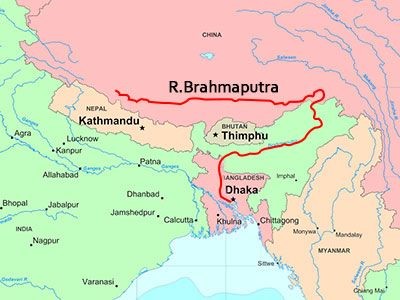
In 1949, after earning an MA in Political Science and working briefly for All India Radio, Hazarika won a scholarship to Columbia University in New York. He completed his Ph.D. in mass communication in 1952. In New York he became friends with the African-American singer, actor and civil rights activist Paul Robeson. The imagery, theme and melody of one of Hazarika’s most famous songs, Bisitirno Paarore (On Your Wide Banks), was heavily influenced by Robeson’s rendition of Ol’ Man River in the 1936 movie version of the musical Show Boat. Oscar Hammerstein II’s lyrics to Ol’ Man River contrast the struggles of African-Americans with the endless, uncaring flow of the Mississippi River. In Hazarika’s version, the Mississippi becomes the Brahmaputra, flowing silently through a world of suffering and moral decay:

Bistirna paarore (On your wide banks)
Axonkhya jonre (That are home to countless people)
Hahakar xuniu (In spite of hearing their anguished cries)
Nixobde nirobe (So silently and unmindfully)
Burha luit tumi (Oh you, Old Luit [Another name for Brahmaputra])
Burha luit buwa kiyo? (How can you flow?)

            After a brief spell of university teaching, Hazarika established himself in Kolkata as a music director and singer. He made several award-winning Assamese films, composed scores for Bengali films and in his later life for Hindi films. As a singer, he was famous for his baritone voice and diction. As a lyricist, he was known for poetic compositions and social and political messages. His songs, including Bisitirno Paarore, were translated into Bengali and Hindi. Hazarika dabbled in politics and for five years served as a representative to the Assam Legislative Assembly, but he always saw his music and films as the most effective forums for social action.

By the time he died in November 2011 at age 85, his fame had spread far beyond his native Assam. An estimated half a million mourners attended his funeral in Guwahati, the state’s commercial capital; a monument opened four years later is now a place of pilgrimage. Fittingly for the artist who composed an ode to a river, Hazarika’s name is on India’s longest bridge, opened in May 2017 by Prime Minister Narendra Modi. More than five miles long, it spans a major tributary of the Brahmaputra, the Lohit, linking Assam and Arunachal Pradesh, saving 100 miles and five hours in travel time between the states.

            Stephanie and I joined the group, which included two writers and a film maker, on the stage, lit incense sticks and scattered lotus petals on the altar. There were short tributes to Hazarika, then the group sang one of his songs. Afterwards, we chatted and thanked them for making us part of the ceremony. “Please wait a few more minutes,” one insisted.  Soon, one member of the group who had slipped away entered through the gate carrying a gamosa, the traditional Assamese scarf, a white rectangular piece of cloth with a red border on three sides and red woven motifs on the fourth. I stood, feeling humble, while two others draped it around my neck.     


Son of Brahma

In India’s so-called “chicken neck,” the seven northeastern states precariously connected to the rest of the country by a narrow strip of land called the Siliguri Corridor, most roads lead to one of Asia’s great rivers, the Brahmaputra, son of Brahma.

FB cover (2) (600x235).jpg

Its headwaters lie on the northern side of the Himalayas on the Angsi glacier in Tibet, where it is called the Tsangpo, the “purifier,” or by its Chinese name, Yarlung Zangbo. It flows east for almost 680 miles before cutting a course north through a series of narrow gorges and then flowing south across the eastern Himalayas through a deep canyon whose walls in places rise to 16,000 feet on each side. The river enters India in the state of Arunachal Pradesh where it is called the Dihang (or Siang). In northeastern Assam it is joined by two major tributaries, the Lohit and the Dibang; beyond this confluence, it is known as the Brahmaputra. Throughout its 450-mile course southwest across Assam, it is fed by tributaries from the north and south. In western Assam, it turns south around the Garo Hills to flow into Bangladesh where it is called the Jamuna. Downstream, it joins India’s other great river, the Ganges (Padma), and the Meghna, ending its 1,800-mile course emptying into the Bay of Bengal.

Brahmaputra map.jpg

Even during the dry season, the Brahmaputra is a massive, untamed river with its banks often several miles apart. It has two high-water seasons—in early summer when the Himalayan snows melt, and during the monsoon season from June to October. Swollen waters submerge river islands, erode the banks and flood farmland. Over the past 250 years, the river’s course has shifted dramatically, as water levels and seismic activity created new channels. Each year, the riverscape changes—new islands, sand bars and levees appear, while older ones are washed downstream.

Cargo boat on Brahmaputra

Cargo boat on Brahmaputra

Millions of people in India and Bangladesh live in the river valley and depend on its waters for survival. The Brahmaputra provides fertile farmland and irrigation, vital for the three annual rice crops; fish caught in the river or harvested from ponds fed by it are a major source of protein. The river is awe-inspiring, and often terrifying; to some, it is sacred. In Hindu mythology, Brahmaputra is the son of the god Brahma, rising from a sacred pool known as the Brahmakund; in its lower reaches in Assam, the river is worshiped by Hindus and temples and monasteries were built on its banks and on river islands.


Hindu monastery (satra) on Majuli Island, Brahmaputra

Hindu monastery (satra) on Majuli Island, Brahmaputra

The Brahmaputra valley is at its narrowest, bank to bank, in western Assam where it cuts through the Garo Hills before turning south towards Bangladesh. For centuries, this was the gateway to the region; whoever controlled it would be able to rule the upper Brahmaputra valley.  In 1671, at the village of Saraighat, the Ahom king, Lachit Borphukan, defeated an invading Mughal army, effectively ending the Mughals’ last attempt to extend their empire into Assam. The first road and rail bridge across the Brahmaputra was opened in 1962 at Saraighat, now a district of the industrial city of Guwahati, the largest city in Assam. For many years, it was the only bridge crossing the river. Today, a second Saraighat bridge relieves traffic congestion, and four other road and rail bridges cross the Brahmaputra upstream.  It’s still a long haul between the six bridges. The Brahmaputra, navigable for most of its length, is a major transportation highway, but also a barrier to north-south commerce. Local people still rely on ferries for travel and trade.

It’s a four-hour road trip along the valley from Guwahati to Tezpur, where I was teaching a two-week university course for junior faculty and doctoral research students. To the south the densely forested hills of the state of Meghalaya, once part of Assam, rose steeply from the valley; to the north, another line of hills was a hazy outline in the distance. Between them, the valley lay flat and fertile. We passed rice paddies, and fields of corn, soya and sugar cane; other crops include rapeseed, mustard seed and jute, used for making rope and baskets. Tall brick kilns with gently curving angles rose from the fields, looking (at least from the distance) like ancient temples.  Every mile or so, we passed a dhaba, the Punjabi word for a roadside restaurant now widely used across India; most had short, easy-to-remember English names—Delight Dhaba, Happy Dhaba, Lovely Dhaba, U Like Dhaba, even Deluge Dhaba. Other roadside establishments are called “hotels,” although only those such as the Dream City Hotel which offered “fooding and lodging” appeared to have rooms to rent.

Decent+Hotel.jpg

For the first 60 miles or so, the road is a divided (although unfenced) highway, with the usual animal hazards. The occasional road sign with an image of a cow seems superfluous, because cattle are everywhere. At the town of Nagaon, Asian Highway 1 branches off southeast towards Nagaland and National Highway 37 becomes a two-lane that meanders through villages and a green landscape of eucalyptus, palm and banana trees and bamboo thickets. Roadside stalls sell bananas, potatoes, sweet potatoes, papayas, jackfruit, coconuts and lychees. During the day, the bicycle and animal traffic is heavy, with chickens and ducks joining the cows and goats. Our driver skillfully braked and swerved, avoiding the trucks and buses hurtling towards us; a couple of times, we idled behind the rump of an elephant until the road ahead was clear.

Most people in these villages live in traditional Assamese houses, simple one or two-room dwellings framed from bamboo or wood, with walls of reeds (locally called ikara) and clay tile roofs. On some, the ikara is plastered with mud to form a rough stucco. Near streams, the houses are built on stilts. Studies have shown that this traditional design, using cheap, lightweight and locally available materials, with flexible connections between walls and roof, stands up well to harsh weather and even earthquakes.

Finally, we turned north off NH37 and headed towards the bridge linking Tezpur with southern Assam. The Kolia Bhomora Setu road bridge, named for one of the Ahom generals who sent the Mughals packing, was opened in 1987. We paid the 20-rupee (30 cents) toll and the attendant pushed aside the rusty metal shelf that substituted for a toll booth arm. And then we were over the Brahmaputra. A small cargo boat, its deck stacked high with bricks, passed under the bridge spans. Small fishing boats seemed suspended in midstream as their crews pulled in the nets. Long, narrow boats with high prows, paddled by a single man standing at the stern, carried half a dozen passengers and a couple of bicycles along the shoreline. Smoke rose from cooking stoves in villages. The setting sun glimmered on the slow-moving water.  It was a view worthy of a postcard or an image in an “Incredible India” TV commercial.


What's in a name?

One indicator of a country’s relationship to its past is how it deals with the reminders of colonial or foreign rule—the statues and plaques honoring administrators and generals, the chapters in school textbooks, the names of cities, towns and streets.

FB cover (2) (600x235).jpg

India has not been in a huge rush to remove reminders of its British colonial past. Since independence in 1947, more than 100 cities and towns have been re-named, but that leaves hundreds more that are still known by their colonial-era names. The changes have included: Mumbai (formerly Bombay), Chennai (Madras), Kolkata (Calcutta), Guwahati (Gauhati), Kanpur (Cawnpore), Kochi (Cochin), Mysuru (Mysore), Pune (Poona), Puducherry (Pondicherry), Shimla (Simla), Tiruchiapalli (Trichinapoly), Thiruvananthapram (Trivandrum), and Varanasi (Benares).

The most recent rash of official changes came in 2014 when the federal government finally approved new names for 12 cities. As usual, there was no way to hurry up the bureaucracy. It had been almost a decade since the government of the state of Karnataka had approved changing the name of Bangalore, India’s fifty largest city, to Bengaluru ahead of the city’s official 500th anniversary in 2006. 

A popular, although historically dodgy, legend has it that the place owes its name to a local king who got lost in the forest on a hunting trip. After hours of aimless wandering, the hungry and exhausted king spotted a hut inhabited by an old woman who offered him boiled beans because that was all she had. Impressed by the hospitality, the king named that part of the forest Bendakaalooru in memory of the meal; in old Kannada, the local language, benda means boiled, kaalu  beans and ooru town or city, making it literally the “city of boiled beans”).  Or perhaps the name is derived from Benga-val-ooru (City of Guards), a reference to the city’s military muscle from the 16th to the 18th centuries. When the British captured the fort in 1791, colonial administrators, perhaps struggling to get their tongues around the Kannada name, dubbed the city Bangalore, and that was how it was known for more than two centuries. During the public debate over reverting to the original name, some tourism and business officials fretted about the impact “the city of boiled beans” might have on the image of the country’s leading IT hub, but most on both sides of the issue expected that the similar-sounding name would be quickly adopted.

Bangalore.jpg
Bengaluru.jpg

It didn’t happen quickly. Although the official signs, airport monitors and websites have been changed, some Indians, including Bengaluru natives, continue to use the old name. The same goes for Mumbai, Chennai and Kolkata, although the latter (the Bengali name) is close enough in pronunciation to Calcutta that sometimes you can’t tell which name is being used. Indeed, many colonial-era city and town names were what the locals called the place, or how the name sounded to the British administrators. There aren’t many real English place names.

Street names are another matter. India’s municipal governments have systematically erased the names of colonial officials from signs and maps. The streets of Central Delhi were once a who’s who of British monarchs, prime ministers, generals, viceroys and colonial administrators—King Edward, King George, Allenby, Canning, Clive, Cornwallis, Curzon, Kitchener, Monto, Reading. They’ve all gone. Kingsway is now Rajpath, Queensway Janpath.

During visits, I try to be culturally sensitive and use the new names, but sometimes get puzzled looks. “Oh, you must mean Bombay. Why didn’t you say so?” My colleague Suruchi Sood, who returns to India at least once a year for work or family visits, reports a moment of panic when she took a domestic flight to Madras. She arrived at the gate and saw that the destination listed was Chennai. For a moment, she thought she was on her way to another city.