Perhaps Stephanie and I missed the billboard, announcing we were entering a new country. After all, I was concentrating on my driving. For most of its length through the mountains of Central Bosnia, the M-17 is a twisting, two-lane road that follows the downstream course of the Bosna, one of the country’s three main rivers. They’re building a new multi-lane highway but until it’s done, the road crisscrosses the river, running through towns and villages where the speed limit seems to change every half mile. The main route connecting the capital, Sarajevo, with the northern agricultural region and points west, north, and east—Croatia, Hungary, and Serbia—is clogged with trucks.
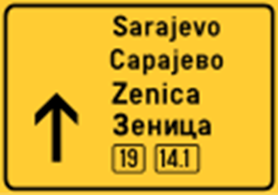
Eventually, the road descended to a wide river plain. South of Doboj, a nondescript industrial city of 70,000, we noticed a change in the black on yellow signs with the names of villages. Travelling north from the Adriatic coast to Sarajevo, then through the mountains, the name was displayed first in the Roman alphabet, with the Cyrillic version below. Now the order was flipped, with the Cyrillic on top.
It was the first sign that we were in Republika Srpska, the Serb-dominated part of the country.
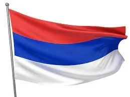
Soon we noticed other differences. In the mining and industrial towns of the mountains, the minarets of mosques rose almost as high as the cooling towers of coal-fired power stations. Now in the rolling, partly forested farmland, the onion domes of Serbian Orthodox churches gleamed in the afternoon sun. On the highway to Banja Luka, the administrative capital of Republika Srpska, its tricolor flag, almost identical to that of Serbia, fluttered in the wind.
To describe the current governance of Bosnia and Herzegovina as the result of messy political compromise would be a gross understatement. After the breakup of Yugoslavia, Bosnia, which is about the size of West Virginia and has a population of just over three million, was torn apart by ethnic conflict. It was a three-way war between Bosnian Croats (supported by Croatia), Bosnian Serbs (supported by Serbia) and Bosnian Muslims, called Bosniaks. It was not until the massacre of 8,000 Muslim men at Srebrenica and TV coverage of the siege of Sarajevo horrified the world that NATO stepped in, bombed Bosnian Serb positions, and forced their leadership to the negotiating table.
In pre-war Yugoslavia, the three communities had co-existed, usually without conflict. Ethnically, they were all Slavs, though of different religious faiths. Most Serbs were Eastern Orthodox, most Croats Roman Catholic. During the 400-year rule of the Ottoman Empire, many Bosnians converted to Islam. Often, it was a matter of convenience rather than conviction; if you wanted to do business in the empire, to trade with Istanbul or Damascus, it helped to share the religion of your customers and suppliers.
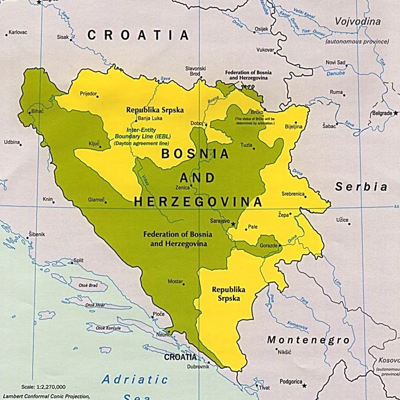
During almost four years of war, many were driven from their homes in mixed communities, or left for their own safety. By the time negotiators sat down at Wright-Patterson Air Force base near Dayton, Ohio, in November 1995, internal migration had created two Bosnias. The Serb-majority north and east (bordering Croatia and Serbia) became Republika Srpska, the central and southern (Herzegovina) regions, with a Bosniak majority and Croat minority, the Federation of Bosnia and Herzegovina (FBiH). Each occupied about half of the country’s land area.
The border between them, inelegantly named the Inter-Entity Boundary Line (IEBL), weaves in and out for more than 1,000 kilometers (670 miles). At several points, one republic juts into the other, with a short strip creating a land bridge to communities dominated by an ethnic group.
The IEBL is no longer guarded or patrolled. Some consider it like the border between two U.S. states, where for most travellers the only noticeable differences are in gas prices or liquor laws. Such a comparison glosses over the fragility of national unity and the intense power politics that hamper Bosnia’s development.
Gerrymandering and political compromise created an awful lot of government. Bosnia has a central government in Sarajevo with a two-house legislature. It also has a president, or rather three; during a four-year term, the chair of the presidency rotates between a Bosniak and a Croat elected by FBiH voters, and a Serb elected by Republika Srpska voters. Perhaps only in Bosnia can a well-informed citizen reasonably ask, “Who’s president this week?”
Although functions such as defense have shifted to the central government, Republika Srpska and FBiH each has its own autonomous government and agencies. The FBiH is also divided into 10 cantons, each with some authority. In most countries, people know which government level or agency is responsible for what, but in Bosnia it’s often a moving target.
Ethnic compromise is represented in other ways. The currency, the convertible mark (KM), uses both the Roman and Cyrillic alphabets, and bills feature the figureheads of both Bosniaks and Serbs. License plates use only letters that are in both alphabets (A, E, O, J, K, M, T) and do not indicate where the vehicle is registered.
Until a few years ago, the alphabet used on road signs switched between Roman to Cyrillic at the EIBL. Today, by law, all signs must be in both alphabets, with only the change in order (as we noted south of Doboj) indicating where you are.
Such well-intentioned changes are largely symbolic because the past looms large. A bloody civil war still lives in the memories of almost everyone over the age of 30. Communities that were once ethnically mixed are now dominated by one group. Two rival governments compete for power and resources. As a country, Bosnia and Herzegovina is a work-in-progress.


