google8d2f7fffcdc71abe.html

Albania: Bazaar and bizarre bric-a-brac

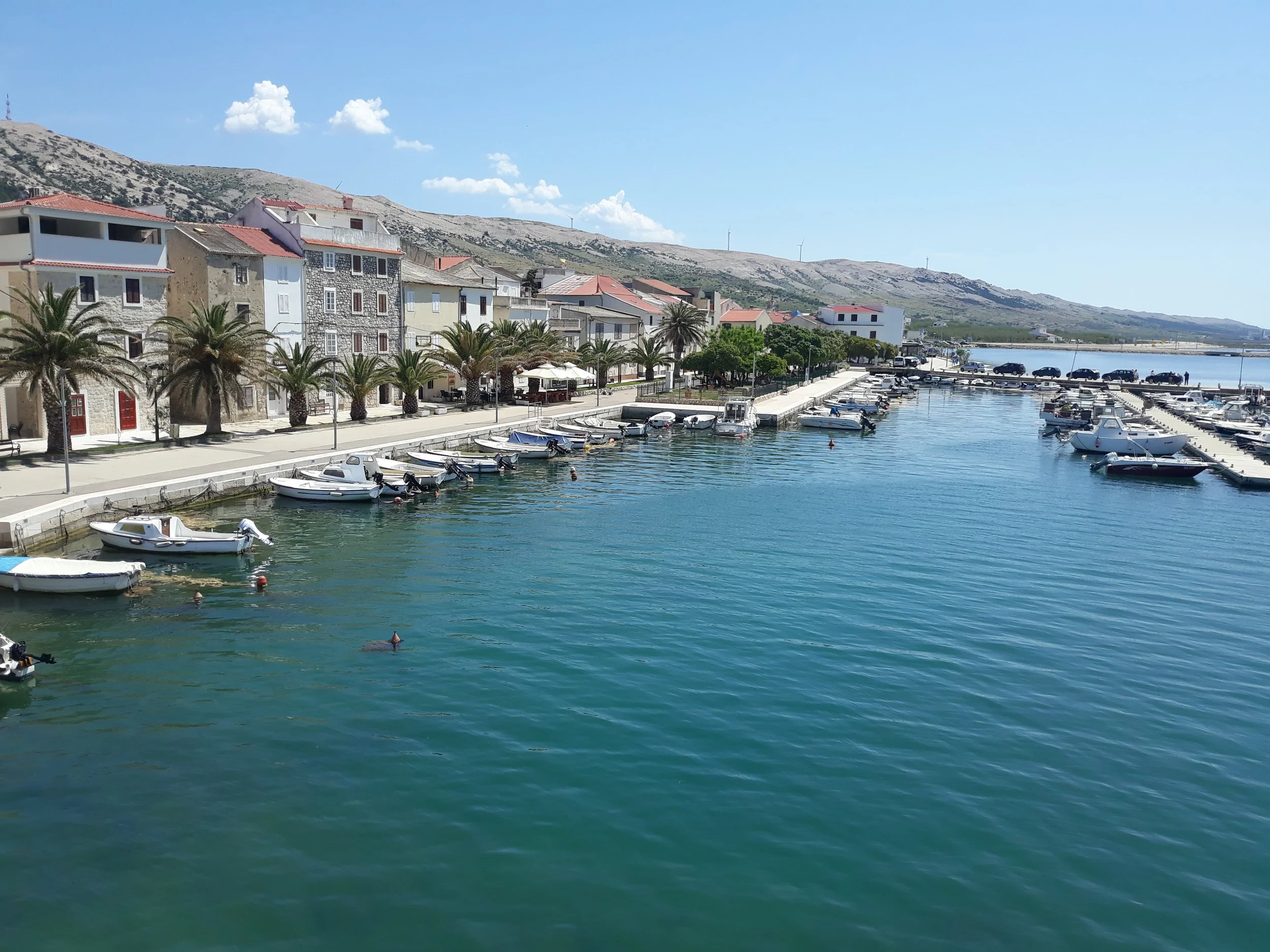
“Um, can you help me?  I’m looking for an antique Albanian ___.” If it’s old and Albanian, you can probably find it on this stall in Tirana’s central bazaar, although you may need to spend some time looking through the dense assortment of bric-a-brac.

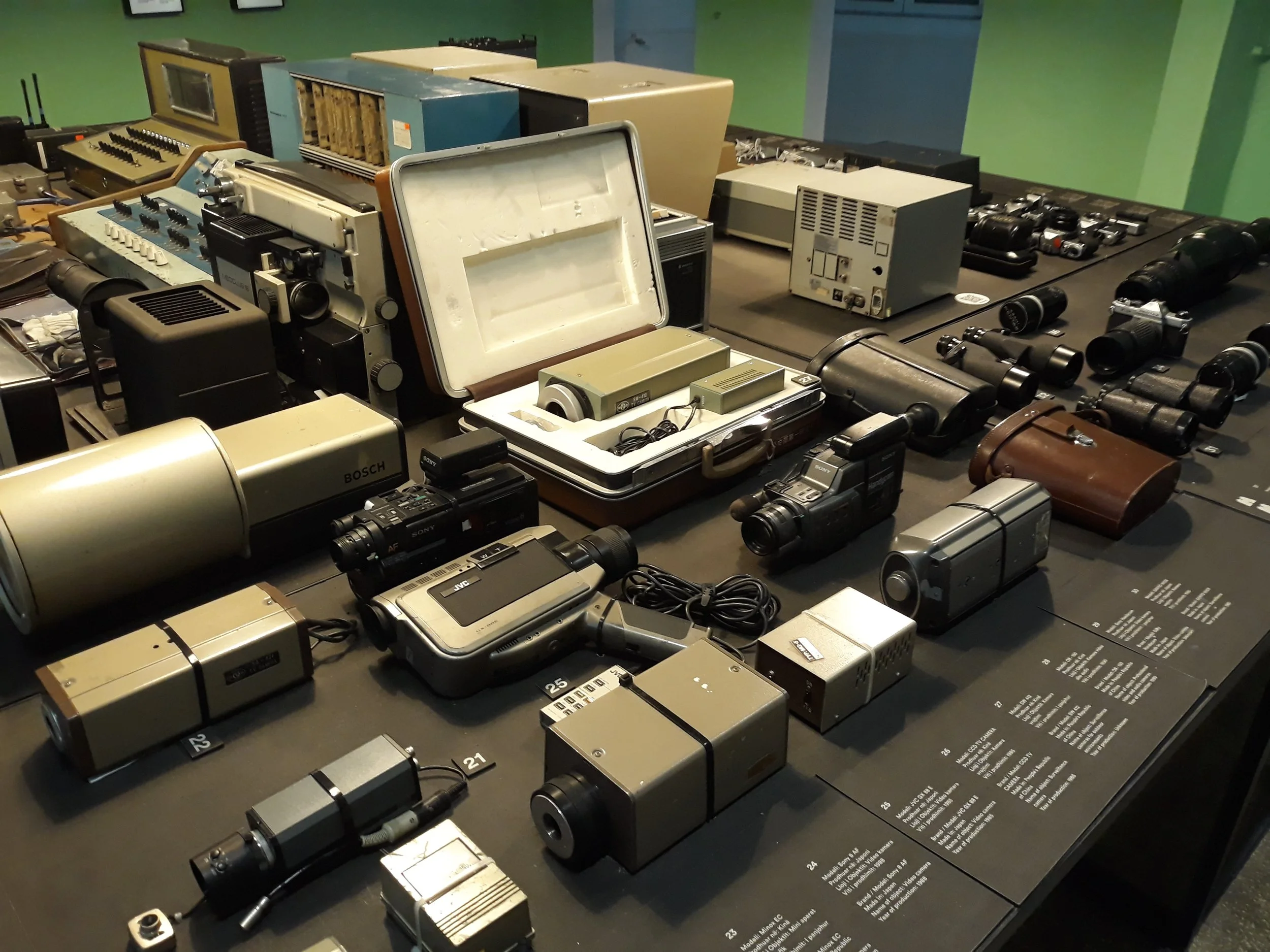
There is a system here. All the communist-era Albanian army caps are in one section (if we can call it a section), along with a few other items of headgear. I suspect that the German army helmet did not originally come with the swastika, that it was a later addition, a stick-on item. All the old cameras in one section, the phones in another. So maybe rather than rummaging, you should whip out your Albanian phrase book and ask the stall owner. And then he can do the sales pitch, spinning an unverifiable yarn about the provenance of the item.

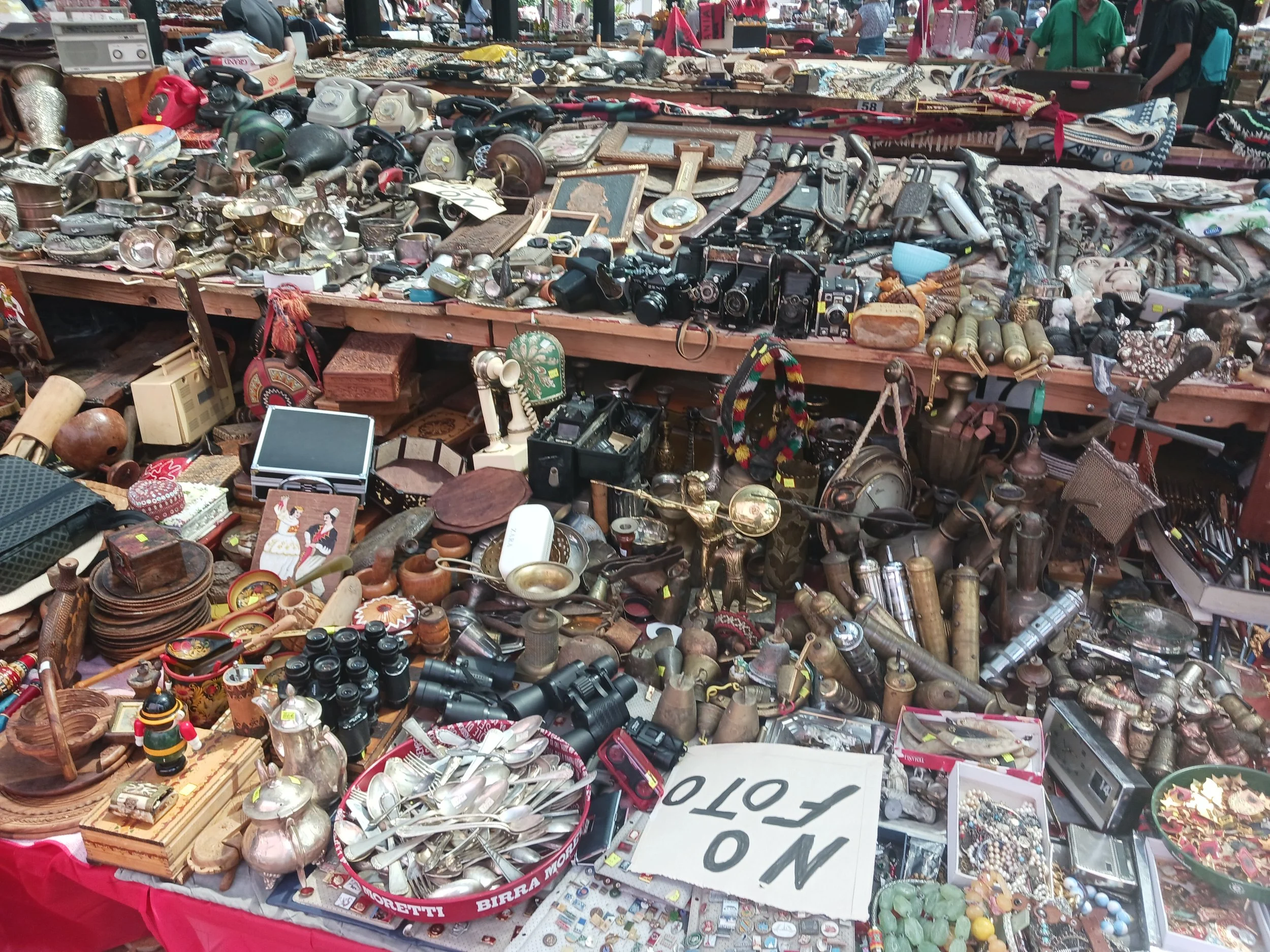
“Ah, you like the dagger in the scabbard? Bought it in Shkoder from the grandson of a partisan who fought in the mountains in 1912 against the invading Serbian army. He was a great hero of our independence.”

“What was his name?”

“I don’t remember it now, but he was a great hero.”

“What about the phones?”

“These were used by the Sigurimi, the secret police, in the communist era. Have you been to the House of Leaves, the Museum of Secret Surveillance? You’ll see phones like these there.”

“Yes, I have, but they just look like ordinary rotary dial phones. We had them in the United States too, and everyone used them. Even the FBI and CIA . How do you know these came from the Sigurimi?”

At this point the stall owner would probably say something about the thriving black market in the early 1990s after the fall of the communist regime, and how he needed to protect his sources.

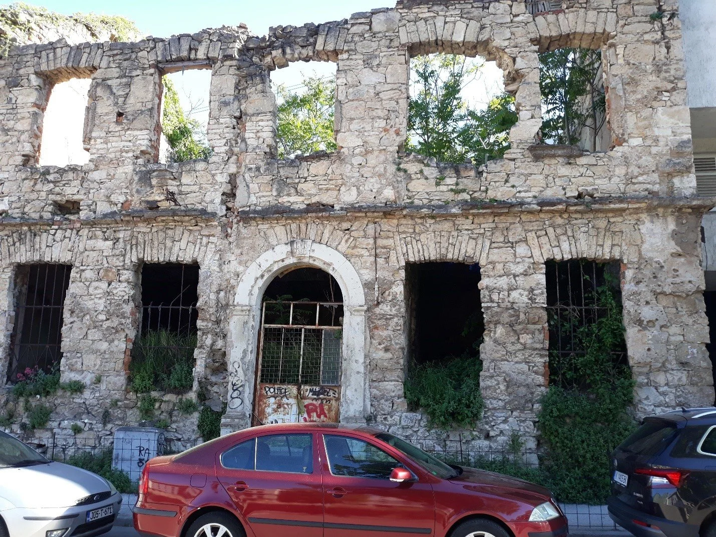
Like many flea market and yard sales items, there’s often a story to tell about how it was acquired. And if there isn’t one, you make it up. Because Albania has such an interesting history—of rebellions against invading armies, of gaining independence from the Ottomans, of the monarchy, of resistance to the Italians and Germans in World War II, of isolation from the rest of the world during the communist era—the narrative possibilities are endless. 

Ferry through the Albanian Alps

The Bradt Travel Guide to Albania describes it as “one of the world’s classic boat trips, up there with the Hurtigrut along the Norwegian coast or the ferry from Puerto Montt to Puerto Natales in Chile.” Stephanie and I haven’t taken either of those so we can’t make the comparison, but will confidently state that it’s worth taking most of a day (in good weather) for the round-trip ferry from Komani to Fierze in the Albanian Alps.

Komani is one of three large artificial lakes formed by a massive hydro-electric scheme built during the communist era in the 1970s and 1980s. The damming of the River Drini and its tributaries not only provided electricity but protected downstream communities, including Shkoder, the economic and cultural capital of northern Albania, from seasonal flooding.  The dams upstream and downstream from Komani changed the landscape, flooding the valley and submerging homes and agricultural land. In what today is Lake Komani, the river already flowed through a deep gorge between sheer limestone cliffs, so the topography was little changed. What would once have been an exhilarating raft or kayak ride is now a calm 2 ½ hour ferry trip with the same spectacular scenery. 

The ferry provides a vital transportation link. Few roads reach the towns and villages of this mountainous region, and those that do require a long circuitous route, in one case crossing the border into Kosovo and then back into Albania. Melting snow and spring rains pour down the slopes, undermining the road surface, causing dangerous subsidence and leaving huge potholes; during heavy rains, some are blocked by mud and rocks. The fastest and safest way from the Adriatic coast to the remote mountain region of Tropoja, its administrative center Bajram Curri and Valbona, a popular resort town and the starting point for mountain hikes, is to take the ferry.

It's a two-hour minibus journey from Shkoder to the Komani ferry terminal, just above the dam. For the first 15 miles, the road runs west through agricultural land and small villages. Then the road twists up to the first ridge and descends through rock-strewn slopes covered with pines and firs to the lower lake on the Drini. For the next hour, it’s a bone-shaking ride up and down the mountains. The driver, who does this route most days of the week, knew the road well, anticipating every tight turn and rough patch where the road surface had crumbled into loose rocks. Finally, we crossed the bridge over the Drini below the dam, and made the last couple of miles on a well surfaced road. We parked in a dark, wet tunnel and walked the rest of the way to the ferry landing.

It was a busy scene, with cars backing up onto the ferry and passengers, some with bicycles, boarding. Officially, the ferry has a ten-vehicle capacity, with the cars and minivans tightly packed on the lower deck. In places, you must breathe in to move between them, or look for an alternate route. On the outward journey, it was just as packed on the two passenger decks, with some people standing for the whole journey.

You quickly forget the crowded conditions as the spectacular scenery unfolds. The ferry took a middle course with towering mountains on all sides.

In places, it appeared to be heading straight for a sheer rock face. Then, at what seemed the last moment, it turned into a new expanse of milky turquoise water that Stephanie compared to the color of glacier melt.

We saw scattered dwellings, accessible only by boat, along the shoreline and others perched high above the lake. The view from the front room must be spectacular, but you have to wonder how far people have to travel on mountain paths to reach even a dirt road. It would be an expedition to go to the market, the clinic or a government office. And in winter, you might be cut off for months by the snow. This is the region where generations of partisans—from those fighting the Ottomans to those who resisted the Italians and then the Germans in World War II—took refuge, launching guerilla raids and then disappearing into the gullies and caves.

In one place, the captain turned off the engine, allowing the ferry to keep moving by the motion already generated. The ferry was passing through an area where plastic trash had accumulated in vegetation. The captain obviously wanted to avoid the trash wrapping around the propellors. It was a sorry sight, and one sign that Albania, a country where solar panels are common and where all the Tirana buses and half the taxis are electric, has a patchy environmental record.

At Fierze, the cars and the cyclists disembarked and headed up the next mountain slope on the road to Valbona. We sat on the terrace of the only restaurant—indeed, it was one of only three buildings—in Fierze, had lunch and felt happy we were not hiking or cycling up the mountain. We boarded the ferry, this time much less crowded, at 1:00 p.m., for the return trip to Koman, and then the bumpy minivan ride back to Shkoder. Of course, we took too many photos.

Albania: Named for a Brazilian footballer

The young man who checked us in at the Hotel Epoka in Shkoder in northern Albania was very helpful. He carried our suitcases upstairs, recommended an excellent restaurant just up the street, and arranged for a minivan pickup to Komani Lake, where we enjoyed a four-hour cruise through spectacular mountain scenery. His English was excellent, and he was always smiling. I wanted to get to know him a little better.

“What’s your name?”

“Denilson.”

I paused. “That sounds like the name of a Brazilian footballer,” I said. Denilson just smiled.

I’ve watched enough Word Cups and followed the English Premier League long enough to know that many Brazilian stars with long Portuguese names prefer to go by a single name. Denilson rang a distant bell, but I wasn’t sure. That evening, I decided to check.  

In his 17-year playing career, Denílson de Oliveira Araújo earned the moniker of the “sultan of stepovers” for his tricks, feints and dribbling skills. He played mostly as a left-winger or left-sided midfielder. In 1998, he broke the world-record transfer fee when São Paulo sold him to the Spanish club Real Betis for £21.5 million. He earned 61 caps for Brazil, making his full debut before his 20th birthday and representing the nation in six international tournaments, including the 1998 and 2002 World Cups.

Back at the reception desk, I showed Denilson a picture of his namesake. “My father loved football,” he said. “After the end of the communist regime [in 1991] he was able to watch international matches on TV. Not surprising he named me after a player he loved to watch.”

“Do you play?” I asked.

“Yes, and I’m pretty good, but do you want to know the real joke? He named my brother Roberto.”

A contemporary of Denilson, José Roberto da Silva Júnior, known as Zé Roberto, played midfield for the Bundesliga clubs Bayer Leverkusen and Bayern Munich and for Brazilian clubs, and had a 10-year international career including two World Cups.

Denilson, Roberto and their father were glued to the TV from mid-June when the 2024 Euros began. Albania was a surprise qualifier, and definitely the underdog. They went out in the group stage, losing narrowly to Italy and Spain but tying their Balkan rivals Croatia 2-2.

Albania: The ruins of Byllis, an ancient city state

It’s not on the usual list of must-see archaeological sites of the Eastern Mediterranean—the Acropolis, Delphi, Olympia. Rhodes, Antioch, Ephesus.  Probably the main reason Byllis is relatively unknown to tourists is because of where it is—in Albania. And, even by Albanian standards, it’s not easy to reach.

Built in the 4th century BC on a hill overlooking the Vjosa River, Byllis was the capital of a small Illyrian republic. The Greeks and Romans used the collective name Illyrians to describe the tribes of the western Balkans (from present-day Slovenia to Albania and North Macedonia), although there’s no conclusive evidence the tribes considered themselves an ethnic group.

Byllis was a city state, with the capital on the hill and villages along the river valley. At one time it was the largest city in Illyria. It had a system of government, minted bronze coins, and traded with other tribes and the Greeks to the south. It is mentioned by Greek authors, Caesar and Cicero as a trading center.

Stephanie and I were staying in Fier, a modern city of about 250,000, to the north. The guidebook told us to take a taxi for the 45-minute trip to Ballsh (its name is probably derived from Byllis), the nearest town, and then a local taxi to Byllis.

Finding that local taxi—at least at a price we were prepared to pay—was not easy. I briefly haggled with an older man who spoke some Russian, but I was not going to pay 30 Euros, Eventually, I asked a cop who instructed a café owner to help us.

Other characters appeared on the scene, including an English-speaking petroleum engineer and his father who ran a currency exchange counter. Phone calls were made and eventually a driver showed up, then left immediately to run an errand. When he returned an hour later, he was with his teenage son, a high school junior, who had skipped school for the rest of the day to practice his English with us. It was tiring responding to a series of non-sequitur questions, so when we arrived at Byllis we politely refused his offer to be our guide and agreed to call when we were ready to leave.

The hilltop site is huge, around 30 hectares according to the guidebook. That’s about 75 acres, or 75 football fields. It’s pretty easy going along the main paths, with descriptive signs in Albanian and English for the main attractions—the stadium, the theater, the agora, the cistern, the Roman bathhouse, the Byzantine basilicas. And stunning views of the river valley and mountain ranges to the south.

The walls and all structures were built from limestone, cut into blocks. Throughout the city’s history, through sieges and conquests, buildings were demolished, and the stone blocks used for new construction, saving the expense and labor of hauling more stone up the hill from the quarry.

For the Romans, who took the city in 229 BC, Byllis offered a strategic location on the route from Apollonia, another Roman city west of Fier and close to the Adriatic coast, and Macedonia.

Within the walls, they built a residential district, laid out on a grid, an arsenal, a bathhouse and sewer system, and public buildings. 

Cistern in foreground, bathhouse back

Historians estimate that the theatre, dating from the 3rd century BC and built into a slope, could accommodate an audience of 7,500.

The city was periodically sacked and burned but always rebuilt. Under the rule of the Byzantine Empire, basilicas with paved mosaic floors were built. The largest, called the cathedral, includes a church, a baptistry and an ecclesiastical palace. Most of the mosaics are covered with sand to protect them from the elements but on the day we visited three were temporarily uncovered for viewing.

In such a massive archaeological site, there’s likely much more to be discovered. Excavations started at the end of World War I and continued intermittently, through regime changes. Given Albania’s current economic state, and the need to shore up education, health and social services, digging up history is not high on the government’s budget agenda. Further funding will likely need to come from UNESCO or sources outside Albania.

Right now, the only commercial business at the site is a small restaurant that sells some guides.  Maybe some day Byllis will join the must-see list, but Stephanie and I are happy we experienced this site and its dramatic location before the crowds arrived.

Albania: The House of Leaves

It’s an impressive display of audio, camera and video gear that was once state-of-the art. Until, that is, the art changed. All the familiar brand names—Sony, Panasonic, Sanyo, JVC, Canon, Nikon—and even Realistic, the Radio Shack store brand. Tabletop cassette recorders with large mechanical buttons for play, record, pause, fast forward and rewind. Bulky camcorders and clunky-looking microphones. Weighty telephoto lenses.

It’s as if someone cleaned out the miscellaneous electronics shelves of a dozen Goodwill thrift stores and brought everything together for a major, invitation-only yard sale for technology buffs who wish everything was still analog. Ah, the good old days when magnetic tape moved across record and play heads.

Only it’s much more sinister than that. These are all devices that Albania’s Sigurimi—the feared state security service—used to spy on suspected enemies of the communist regime. For almost half a century, from 1944 to the fall of the regime in 1991, the Sigurimi monitored the activities and communications of ordinary citizens suspected of subversive activities, black marketeering or simply of telling a bad joke about the regime. One branch of the Sigurimi was tasked with surveillance of diplomats and the few foreigners who were allowed to visit on organized tours. 

Agents planted bugs, installed secret microphones and cameras in the walls of apartments and offices, tapped telephone lines, intercepted mail, and trailed suspects on foot or in unmarked cars. A network of paid informants added to the so-called intelligence, some using their cozy relationship with the regime to settle scores with neighbors or estranged family members.

In a paranoid system where “enemies of the people” lurked everywhere, it was often enough to just make an accusation. The Sigurimi would interrogate and sometimes torture the suspect. After a summary trial, the enemy of the state would be publicly denounced—a not-so-subtle message to family and friends to toe the party line—then sent to one of the notorious labor camps to build roads and railroads, or work in factories and mines. Many died from starvation, heat exhaustion, or disease.

The surveillance devices, and other records and artifacts from the archives of the Ministry of Internal Affairs, to which the Sigurimi reported, are brought together in a remarkable exhibition at what was until 1991 the agency’s headquarters, a former maternity clinic. It was known as the House of Leaves, because, on a busy street in the center of Tirana, it was always eerily quiet, except for the rustle of fallen leaves in the garden. It was, to quote from one exhibit caption, “The place from where you can see and hear everything.”

For the first 20 years, the Sigurimi used audio tape recorders and microphones supplied by the Soviet Union, only a few of which have survived. After the break with Khrushchev, the new communist ally, Mao Tse-Tung’s China, supplied camera gear such as this telephoto lens, but did not produce the quality of audio and video equipment needed for surveillance.

When Albania broke with China in 1978, declaring itself “the only socialist state in the world,” even that supply line dried up. Where could the Sigurimi acquire new equipment?  From the capitalist West, of course. One wall of the exhibit room displays rows of German-made Uher reel-to-reel recorders, a sturdy and sophisticated model that I used when I worked at the University of Kansas public radio station in the late 1970s.

Of course, the Sigurimi did not send bulk purchase orders to manufacturers or wholesalers. Their agents, stationed in Western European countries to monitor the activities of opposition figures and dissidents, simply went shopping with hard currency for consumer and professional quality equipment.

You can’t blame the technology; the issue is the purpose for which it was used. In the West, the same cassette recorders and camcorders were being used to record music, tape radio programs off-air, and shoot family celebrations. Western governments could not control what Sigurimi agents bought on the high street or at the mall and the dealings were all in cash. If a store clerk was curious, the agent would simply and disarmingly say he wanted to buy the best-quality camcorder on the market so his family would have a lasting memory of daughter’s wedding. Just like any other family.

Albania: Take the long-distance bus

For many Albanians, all roads lead to a large parking lot surrounded by concrete apartment blocks and commercial high rises in the northern suburbs of the capital, Tirana.

By most macro-economic measures, Albania is still the third poorest country in Europe (after Ukraine and Moldova) and by a small margin the poorest in the West Balkans. According to 2021 statistics from the transport ministry, it has the lowest car ownership rate in Europe, with just one in five citizens owning a vehicle.

Those numbers need to be taken with a large pinch of salt—or maybe a shot of Albanian raki—because Albanians are famously distrustful of government and sometimes experience temporary memory loss when personal property taxes are involved.  But even if the growing economy has boosted car ownership, it’s still not an option for the working and lower middle class. They take the bus.

Stephanie and I joined them on our trip north to Shkoder, the commercial and cultural capital of northern Albania, and then, three days later, to Berat, the breathtakingly beautiful “city of a thousand windows” with a medieval fortress in the Tomorri mountain range south of the capital.

It’s a 30-minute (depending on traffic) $10 cab ride from central Tirana to the prosaically named North/South (Veri/Jug) bus terminal just off the airport road, across the roundabout from the Casa Italia shopping center and the Waikiki Outlet Mall. Calling it a “terminal” is an overstatement. It’s just a large asphalt parking lot with coaches and minibuses lined up on two sides—northern destinations to the left, southern to the right. The facilities are, well, lacking. There are no sheltered areas and no seats. When we asked for directions to the toilet, a driver guided us to a gap in the hedge that lines one side of the lot and pointed us to a café a short block away.

As far as we could tell, all long-distance buses are run by private operators. There are no bus company logos, so we assume most are small operations—maybe just one bus with the driver and conductor, run as a family business. It may sound chaotic, but it’s a very efficient system. All buses have their destination posted in the windshield.

As the Bradt travel guide notes, the “common denominator is that they run to timetables.” Outside the North/South station, the schedules are posted on boards, with the earliest buses leaving at 5:30 or 6:00 a.m., especially for destinations in the far south or western Kosovo.

The three buses we’ve taken so far—to Shkoder and back, and from Tirana to Berat—were comfortable, air-conditioned and left right on time. Arrival time is more iffy—partly because of traffic but also because the buses pick up and drop off passengers along the route, sometimes in a town or village, sometimes at a gas station or café. They also operate an informal package delivery service. As we waited for the Shkoder bus to depart, cars and motorcycles rolled up and handed over packages to the conductor who stashed them in the luggage compartment to be picked up on arrival.

Stephanie at the Shkoder bus

It's not only an efficient system but (at least for us) an inexpensive one. It’s about 75 miles from Tirana to Shkoder, about 90 to Berat. The fare was 500 lek (just over $5) for a 2-2/12 hour trip. That’s a total of 1,000 lek, which is what we paid for the cab from central Tirana to the bus station.

Albania: No hippies, please

If you wanted to travel cheap in Europe in the 1970s, your bible was The Hitch-Hiker's Guide to Europe by Australian expatriate Ken Welsh, first published in 1971.  It contained advice on hitching technique and etiquette, where to sleep and eat cheap, and what to expect when you came to a national border. 

Twenty years before most European Union countries abolished passport and border controls under the Schengen Agreement, travelers faced a confusing set of national regulations. The countries of the communist Eastern Bloc were particularly tricky, requiring visas and sometimes a “service fee” to the mean-looking uniformed guy with the Kalashnikov who was standing in front of your vehicle.

None, however, was trickier than Albania. In the 1972 edition of The Hitch-Hiker's Guide, the entire contents of the subsection on Albania consisted of just two words. "Forget it."

Since the communist regime came to power at the end of World War II, Albania had been, to all intents and purposes, a closed country. Except for politicians, diplomats, and sports teams, few were allowed to leave. Anyone caught trying to skip across the border to Yugoslavia or Greece was likely to be shot or, if arrested, sent to a labor camp where they might die of starvation or disease. To maintain socialist purity, Albania did not welcome foreign visitors, except a few on supervised tours.

Albania had refused to join the other republics of the western Balkans in the Yugoslav Federation which, under the leadership of Marshal Tito, had broken from Stalin and adopted its own kinder, gentler version of communism.

Albania became a satellite of the Soviet Union, dependent on aid from Moscow and with Soviet army, naval and air force bases around the country.  Relations began to deteriorate after Joseph Stalin’s death in 1953, with Albania’s authoritarian leader, Enver Hoxha, accusing Stalin’s successor, Nikita Khrushchev, of abandoning the true principles of Marxist-Leninism.

Where could this small country turn to after breaking with the Soviet Union?  There was only one place to go—to the great communist rival, the China of Mao Tse-Tung. 

As Eri Xhikola, my guide on a walking tour of the capital, Tirana, put it: “We took the worst of Stalinism, combined it with the worst of the Cultural Revolution and created a real mess.”

If Hoxha and his secret police, the Sigurimi, were worried about foreign agents and influences in the Stalin-Khrushchev era, their paranoia increased as they implemented their own version of the cultural revolution, sending professionals to the countryside to work on collective farms and bringing uneducated farmers to the cities. The result—economic stagnation and rampant corruption.

Of course, you don’t know you’re poor unless you see people who look like you who are living better than you do. That’s why the myth of the socialist paradise was maintained through the control of information and restrictions on foreigners entering the country for fear they talked about what they earned and owned.

The Sigurimi closely monitored the movements and contacts of the small cadre of foreign diplomats in Tirana, following them in unmarked cars, bugging their apartments and enlisting their local staff as informers. They placed agents as receptionists at the only two hotels in the city where foreigners were allowed to stay. Rooms assigned to foreigners were under 24-hour surveillance, with hidden microphones connected through a switchboard and patched in directly to Sigurimi headquarters.

“The People’s Republic of Albania,” Hoxha once declared, “is closed to enemies, spies, hippie tourists and other vagabonds.”

To maintain what it called “socialist aesthetics” and to make some foreign exchange, the government maintained barber shops and clothing stores at all border crossings. Foreigners were informed that “if they choose to be adjusted—to cut their hair, to dress normally,” they could enter.  No doubt some refused and turned back, probably echoing the Hitch-Hiker’s Guide advice, “Forget it.”

One of the minor consequences of the restrictive policy is a dearth of travel literature on Albania in this period.  A few glimpses of what it was like to travel there came in letters in response to a travel feature in The Guardian. One reader recalled:

“Progressive Tours organized package holidays to Albania in 1972—we remember that company because we joked about the holiday getting progressively worse the longer it lasted. No personal exploring was allowed … Organised trips were to communal farms and the Ho Chi Minh cotton factory, ignoring the hilltop castles and archaeological sites we passed.”

Today, a half century later, Albania welcomes tourists. According to tour guide Eri, about three million visited the country in 2019, the last year before the COVID epidemic. “We expect six million in 2023,” he said. I said I was happy to be one of them.

Albania's bunker mentality

“There are a total of 173,731 bunkers, and the average cost was 1,000 U.S. dollars.”

As usual, my Tirana city tour guide, 31-year-old history graduate Eri Xhikola, had the statistics at his fingertips.

“That seems awfully precise, has anyone actually counted them?” I asked.

Eri allowed that it was an official statistic, and that no one knew exactly. The Bunk’art 2 museum more cautiously puts the number at “around 175,000.”

We were standing in a park in the upscale residential area of Blloku, where the communist party elite, including leader Enver Hoxha, once lived. Today, it’s a lively area of shops, bars, restaurants, and night clubs. We were looking at a small, shallow concrete bunker, where two soldiers could shelter from bombs and shells and crouch to shoot at the Americans, the Russians, or whoever happened to be invading the socialist paradise.

Bunkers were constructed all over the country. They ranged in size and depth, from simple ones to the elaborate nuclear shelter of the Ministry of Internal Affairs. It has four corridors, at least 50 rooms, and a heating, electrical and water system. Like the simple one, it was never used because in the communist era no one ever bothered to invade Albania. It now houses the Bunk’art 2 museum depicting the history of Albania’s police force and its notorious secret police, the Sigurimi.

“Who did they think was coming?” I asked.

“They were worried about the Americans, but mostly they feared the Soviet Union,” said Eri.  During the Khrushchev era in the 1960s, Albania had broken away to ally with China. Hoxha refused to reimburse Moscow for all the military hardware it had sent since the end of World War II. He feared that the Soviet Union would send in the repo squad.

Near the bunker stands a series of poles and roof beams that once reinforced the tunnel of a copper mine. It was brought to the park from one of the labor camps where the regime sent political prisoners, dissidents, and common criminals to work in appalling conditions.

And, in a symbol of the fall of communism, there’s a section of the Berlin Wall, a present from the newly unified Germany.

“We asked if we could send them some bunkers as a return gift, but they said they already had enough in East Germany,” said Eri. I wasn’t sure if he was joking.

Albania: The colors of Tirana

When Edi Rama was elected mayor of Tirana in 2000, he had ambitious plans to transform the infrastructure and image of Albania’s capital. For half a century it had looked like most other communist-era cities, their grandiose public buildings, boulevards, and squares hiding blocks of drab, grey apartment blocks, built from prefabricated concrete.

Rama had more imagination than most politicians, perhaps because of his diverse background. He was a painter, writer, university lecturer, publicist, and former basketball player. During his decade as mayor, the existing road system was expanded, potholes filled, public transport improved, and thousands of trees planted. Those improvements were needed, but did little to change the city’s image.

Rama was a socialist, but that did not mean he bought into the everyone-has-to-live-in-an-apartment-that-looks-like-everyone-else’s ideology. His one-word solution? Paint.

Rama earned international recognition by having the facades of apartments and other buildings repainted in bright colors, what one observer described as “a continuous palette shift from lemon to lime, saffron to cinnamon and burgundy to baby blue.” OK, so some locals grumbled that their city had fallen victim to a made-for-TV makeover, but it beat the hell out of gray and faded white and yellow, apparently the only colors in the communist-era palette.

On a sunny morning, I walked to the Faculty of Social Sciences of the University of Tirana on the tree-lined boulevard along the River Lana, one of the best places to observe how Rama attempted to paint Tirana into the modern day.

The rush to color was infectious, with artists painting murals on walls, the sides of buildings and, in this case, the side of an electricity sub-station.

Most public buildings around the central square that honors the Albanian national hero Gjergj Kastrioti Skënderbeu have been repainted in shades of red, pink and yellow. My unofficial prize for “most attractive color design” goes to the Polish embassy.

Polish embassy, Tirana

Tirana is in the middle of a construction boom. The architects of office and condo high rises have followed Rama’s color script, even if some colors look a bit garish.

Even in mid-January, the street booksellers are out in force. Every morning, they unload their stocks of second-hand editions—from textbooks to classics to pulp fiction—and every evening they pack up again. Another splash of color.

 And then there’s the fruit. Mandarins are in season, with fruit falling from trees on some streets. There are apples, pears, oranges, and pomegranates. At this stall in the city center, the mandarins were 80 leke (about 75 cents) a kilo. It sounds cheap, of course, but remember that incomes are significantly lower than in most European countries.   

In 2004, Rama’s achievements in transforming the infrastructure and appearance of Tirana and helping turn it into a tourist destination earned him the inaugural World Mayor prize. Like the city he administered, his star was rising. For the last decade, he has served as Albania’s prime minister.

Bosnia: 'We are Tito'

In my travels, I’m always intrigued to find examples of iconic historical figures of communism, summarily stripped of ideology and turned into capitalist brands.

In 2003, as Cuba was taking its first steps towards a market economy, the hottest item on the market I visited in Havana was a T-shirt with the classic image of Che Guevara—the same one painted on walls with revolutionary slogans--and his trademark beret.

In 2005, in Yekaterinburg in Russia’s southern Urals, a popular interior design choice for upscale bars and restaurants was Soviet retro—reproductions of Pravda front pages, grainy blown up photos of May Day parades in Moscow’s Red Square, posters urging farm and factory workers to meet production quotas, and portraits of Lenin, Stalin and Khrushchev.

In 2012, at a resort in the Tien Shan mountains of southeastern Kazakhstan, an imitation of the classic Lenin statue, his right arm raised as if pointing towards a misty socialist nirvana. Except that he’s not—he’s pointing the way to the Russian restaurant. I titled a short essay “Lenin’s commercial arm.”

And in 2022 in Sarajevo, the capital of Bosnia and Herzegovina, the We Are Tito café.

When Josip Broz was born in 1892 to a Croat father and Slovene mother, the northern Balkans were part of the Austro-Hungarian Empire. Drafted into the army, he was seriously wounded and captured by the Russians in World War I. After the war, he returned to the new Kingdom of Yugoslavia and joined the communist party. When the party was banned in 1920, he took the name Tito, as other members did, to avoid detection. In World War II, he led the Partisans, the Yugoslav guerrilla movement, against the occupying Nazi forces. In 1945, the Partisans, backed by the Soviet Union, came to power.

Tito served as prime minister, president, and later president for life of the Socialist Federal Republic of Yugoslavia until his death in 1980. Unlike other leaders in the Soviet bloc, he broke with Stalin. He established a domestic form of market socialism where firms were owned and managed by their employees and competed in open and free markets.

Tito kept a lid on ethnic tensions by delegating as much power as possible to each republic. Under the 1974 constitution, Yugoslavia was defined as a "federal republic of equal nations and nationalities, freely united on the principle of brotherhood and unity in achieving specific and common interest."  A leader of the so-called Non-Aligned Movement in the 1960s and 1970s, Tito was popular both in Yugoslavia and abroad. Although some historians criticize his authoritarian rule, others see him as a benevolent dictator who held the country together. Tito is credited with transforming Yugoslavia from a poor to a middle-income nation, a process that saw vast improvements in women's rights, health, education, and the economy. He ranked first in a 2003 “Greatest Croatian” poll.  In a 2010 poll, four out of five Serbs believed that life was better under Tito.

Nostalgia is evident throughout the former Yugoslavia. One historian writes that Tito’s cult centres around his persona as a common man, a friend of the people, in contrast to Stalin who was depicted as a “cold, aloof god-like figure whose extraordinary qualities set him apart from ordinary people.” In Croatia some remember him as “a sort of secular saint” and hang his portrait on the wall beside those of Catholic saints.

‘Long live Tito’ graffiti, Mostar, Bosnia

After the break-up of Yugoslavia, many towns and cities changed their communist-era street names to those of national figures. However, Tito’s name is preserved in streets and squares in all the republics. Stephanie and I enjoyed a fine lunch at a restaurant on Ulica Maršala Tita, the main drag in the Croatian seaside resort of Opatija. Tito lends his name to city squares in Rjeka, the third largest city in Croatia, and Koper, the largest port city in Slovenia, to downtown streets in Sarajevo and Mostar in Bosnia, and to numerous streets in northern Serbia.

Street sign in We are Tito cafe

The We Are Tito Café, in a park behind Sarajevo’s Historical Museum, a few blocks from the western end of the broad Ulica Maršala Tita, celebrates all things Tito. Inside are posters, portraits, newspaper pages, red flags, and a bust of the revered leader. 

Beside the terrace is a motley collection of old Yugoslav military vehicles, including a World War II-era tank and a jeep. It’s a favorite weekend hangout, where parents sitting on camouflage-covered stools watch their children climbing over the tank and sliding down the barrel of an artillery piece. Visually, it seems an ironic commentary on the conflict that tore Yugoslavia apart and destroyed Tito’s legacy of peace and unity.

Bosnia: They all died in 1993 …

A few steps away from The Bulevar, the main drag in the city of Mostar in southern Bosnia, the cemetery across from the 16th century Karadjoz Bey Mosque offers a quiet, shady spot away from the crowds.

I’ve always liked wandering around cemeteries—from damp English country churchyards to overgrown family burial grounds in the West Virginia hills to the ancestral stone tombs of Madagascar’s central highlands. Unless you are looking for someone famous or a long-forgotten family member, most names on the headstones do not mean much. Yet you can’t help thinking about the origins of the names, why these people settled in this place, their occupations, their families, why they lived so long or died so young.

Almost every cemetery has graves from several generations and centuries—in the US, the weathered headstones of Civil War veterans side by side with those from World War II and Vietnam, sometimes several generations clustered together in a family plot.   

The Mostar cemetery is unlike any I have ever seen because almost everyone died within a few months in a single year. Some were elderly, some middle-aged, some in their twenties and thirties, and some in their teens. Line after line of headstones, some marking the month of death as May or June of 1993.

From the late Middle Ages, Mostar was a market town on the trade route between the mineral-rich mountain regions of central Bosnia and the Adriatic coast. It was named for the mostari, the bridge-keepers who guarded the rickety wooden bridge (most) that crossed the gorge of the Neretva River. In 1566, the Ottoman sultan Suleiman the Magnificent ordered the construction of a stone bridge, 92 feet long and 66 feet high, that became a wonder in its own time. One 17th century traveller wrote:

The bridge is like a rainbow arch soaring up to the skies, extending from one cliff to another … I, a poor and miserable slave of Allah, have passed through 16 countries, but I have never seen such a high bridge.

The Stari Most (Old Bridge), as it came to be known, became the symbol of a multi-ethnic city. It linked the east bank of the Neretva, with its bazaars and twisting alleys, dotted with mosque minarets, with the west bank.  In the 19th century, under the Ottoman and the Austro-Hungarian Empires, the river plain to the west was laid out with tree-lined boulevards, stately mansions, and ornately decorated public buildings. After World War II, the communist regime of Marshal Tito built factories to produce textiles, plastics, aluminum, wine and tobacco, and erected blocks of Soviet-style prefabricated concrete apartment blocks to house the growing population.

The east bank was inhabited mostly by Bosniaks (Bosnian Muslims), the west by Croats and Serbs. All were ethnic Slavs, separated only by religion, with most Croats Catholics and most Serbs Orthodox.  As long as Yugoslavia held together, conflicts were rare. In 1991, Mostar had a population of 127,000; Bosniaks and Croats each made up about one third, with about one in five identifying as Serbs.

The unity, and later the bridge that represented it, came tumbling down in April 1992 after Bosnia and Herzegovina, following the lead of Slovenia and Croatia, but without the support of its Serb minority, declared independence from Yugoslavia. The Serb-dominated Yugoslav People’s Army occupied the east bank, forcing Bosniaks and Croats to flee. Serb artillery destroyed public buildings, Catholic churches and mosques, and several bridges. Wandering around the city today, almost 30 years later, you still pass the shells of burned-out buildings. Remarkably, the Stari Most still stood, providing a vital link between east and west banks.

Behind the scenes, Serb and Croat leaders were negotiating to divide Bosnia, and agreed Croatia would claim Mostar. After the Serb forces retreated, residents returned to the east bank to rebuild their homes and mosques. A year later, Croat forces swept through the city, forcibly removing Bosniaks to the east bank and sending men to concentration camps. From a mountain top, today marked ironically by a huge white cross, Croat artillery pounded the east bank. Snipers picked off people venturing out of their homes in search of food.

According to their faith, Muslims wash and bury a body soon after death. Because existing cemeteries were exposed, east bank residents used the city park opposite the Karadjoz Bey mosque as an emergency burial ground. Although the trees provided cover from snipers, many burials, both of soldiers and civilians, took place after dark.  

Croat artillery began shelling the Stari Most in November 1993. There was a strategic objective—to isolate a Bosniak-controlled strip on the west bank, forcing soldiers to move across the river and cutting off the area from food supplies. The attack also had a symbolic significance—the bridge, built by the Ottomans, represented the city’s Muslim legacy.

The Croat-Bosniak conflict ended in 1994, and the independence of Bosnia and Herzegovina formalized in the 1995 Dayton Agreement. The city pledged to rebuild the Stari Most authentically. Stone blocks were cut from the original quarry and hand carved; workers perching on wooden scaffolding fastened them together with iron hooks cast in lead. Today, the bridge is a UNESCO World Heritage Site and the most-visited tourist site in Mostar.

Walking along the pedestrianized Bulevar, with its shops, bars, restaurants, hotels, and stalls selling tourist kitsch, it’s easy to forget that this street was once the front line in the war, and anyone crossing it in daylight risked being cut down by a sniper’s bullet. Close to the cemetery, the Museum of War and Genocide Victims features individual testimonies (translated into English) from victims. Many are linked to an artefact—a diary, a letter, clothing, a common household item—that belonged to the victim.

At the home of a prosperous Ottoman merchant family, now a small museum, the guide, a Bosniak in her late twenties, gave us the tour, then talked about her family’s experiences in 1993. “It was a miracle we survived. Food was scarce. My mother was pregnant with me and my twin sister, but sometimes all she had to eat was grass. The experience changed my father forever. He is moody, maybe it’s PTSD, I don’t know.”

I asked if her generation, which had not experienced the war, felt differently about other ethnic groups. “There was this boy I really liked, a Serb.  He liked me too, but told me ‘I’m sorry but this can’t work—you’re a Muslim, I’m Orthodox.’”

She apologized for crying. “I usually don’t get like this,” she said. I said I understood, although in my heart I knew I could never really understand what happened in Mostar in 1993.

Bosnia and Herzegovina, a work in progress

Perhaps Stephanie and I missed the billboard, announcing we were entering a new country. After all, I was concentrating on my driving. For most of its length through the mountains of Central Bosnia, the M-17 is a twisting, two-lane road that follows the downstream course of the Bosna, one of the country’s three main rivers. They’re building a new multi-lane highway but until it’s done, the road crisscrosses the river, running through towns and villages where the speed limit seems to change every half mile. The main route connecting the capital, Sarajevo, with the northern agricultural region and points west, north, and east—Croatia, Hungary, and Serbia—is clogged with trucks.   

Eventually, the road descended to a wide river plain. South of Doboj, a nondescript industrial city of 70,000, we noticed a change in the black on yellow signs with the names of villages. Travelling north from the Adriatic coast to Sarajevo, then through the mountains, the name was displayed first in the Roman alphabet, with the Cyrillic version below. Now the order was flipped, with the Cyrillic on top.  

It was the first sign that we were in Republika Srpska, the Serb-dominated part of the country.

Soon we noticed other differences. In the mining and industrial towns of the mountains, the minarets of mosques rose almost as high as the cooling towers of coal-fired power stations. Now in the rolling, partly forested farmland, the onion domes of Serbian Orthodox churches gleamed in the afternoon sun.  On the highway to Banja Luka, the administrative capital of Republika Srpska, its tricolor flag, almost identical to that of Serbia, fluttered in the wind.

To describe the current governance of Bosnia and Herzegovina as the result of messy political compromise would be a gross understatement. After the breakup of Yugoslavia, Bosnia, which is about the size of West Virginia and has a population of just over three million, was torn apart by ethnic conflict. It was a three-way war between Bosnian Croats (supported by Croatia), Bosnian Serbs (supported by Serbia) and Bosnian Muslims, called Bosniaks. It was not until the massacre of 8,000 Muslim men at Srebrenica and TV coverage of the siege of Sarajevo horrified the world that NATO stepped in, bombed Bosnian Serb positions, and forced their leadership to the negotiating table.

In pre-war Yugoslavia, the three communities had co-existed, usually without conflict. Ethnically, they were all Slavs, though of different religious faiths. Most Serbs were Eastern Orthodox, most Croats Roman Catholic. During the 400-year rule of the Ottoman Empire, many Bosnians converted to Islam. Often, it was a matter of convenience rather than conviction; if you wanted to do business in the empire, to trade with Istanbul or Damascus, it helped to share the religion of your customers and suppliers.

During almost four years of war, many were driven from their homes in mixed communities, or left for their own safety. By the time negotiators sat down at Wright-Patterson Air Force base near Dayton, Ohio, in November 1995, internal migration had created two Bosnias. The Serb-majority north and east (bordering Croatia and Serbia) became Republika Srpska, the central and southern (Herzegovina) regions, with a Bosniak majority and Croat minority, the Federation of Bosnia and Herzegovina (FBiH). Each occupied about half of the country’s land area.

The border between them, inelegantly named the Inter-Entity Boundary Line (IEBL), weaves in and out for more than 1,000 kilometers (670 miles). At several points, one republic juts into the other, with a short strip creating a land bridge to communities dominated by an ethnic group.

The IEBL is no longer guarded or patrolled. Some consider it like the border between two U.S. states, where for most travellers the only noticeable differences are in gas prices or liquor laws. Such a comparison glosses over the fragility of national unity and the intense power politics that hamper Bosnia’s development.

Gerrymandering and political compromise created an awful lot of government. Bosnia has a central government in Sarajevo with a two-house legislature. It also has a president, or rather three; during a four-year term, the chair of the presidency rotates between a Bosniak and a Croat elected by FBiH voters, and a Serb elected by Republika Srpska voters. Perhaps only in Bosnia can a well-informed citizen reasonably ask, “Who’s president this week?”

Although functions such as defense have shifted to the central government, Republika Srpska and FBiH each has its own autonomous government and agencies. The FBiH is also divided into 10 cantons, each with some authority.  In most countries, people know which government level or agency is responsible for what, but in Bosnia it’s often a moving target.

Ethnic compromise is represented in other ways. The currency, the convertible mark (KM), uses both the Roman and Cyrillic alphabets, and bills feature the figureheads of both Bosniaks and Serbs.  License plates use only letters that are in both alphabets (A, E, O, J, K, M, T) and do not indicate where the vehicle is registered.

Until a few years ago, the alphabet used on road signs switched between Roman to Cyrillic at the EIBL. Today, by law, all signs must be in both alphabets, with only the change in order (as we noted south of Doboj) indicating where you are.   

Such well-intentioned changes are largely symbolic because the past looms large. A bloody civil war still lives in the memories of almost everyone over the age of 30.  Communities that were once ethnically mixed are now dominated by one group. Two rival governments compete for power and resources. As a country, Bosnia and Herzegovina is a work-in-progress.

Bosnia's very short coastline

Even for the Balkans, a region with more than its fair share of crazy national borders, it’s an oddity—a five-and-a-half-mile stretch of Bosnia on the coast of Croatia.

Cobbled together at the 1995 Dayton Accords after four years of inter-ethnic conflict, Bosnia and Herzegovina is hardly a maritime nation. It has no navy or merchant fleet. There’s just one town, Neum (population 3,000), on its coast. Most of the boats in its small harbor look as if they’re kitted out for sports fishing or island-hopping parties, not international commerce.

Traveling south on the coast road to the ancient walled city of Dubrovnik, the top tourist destination on Croatia’s Adriatic coast, you need to show your passport twice—on entering Bosnia and (depending on the traffic) 15 or 20 minutes later on re-entering Croatia. Usually it’s a cursory check to make sure the people in the vehicle match their passport pictures.  However, from 2023 when Croatia joined the European Schengen Area for border-free travel, the border police had to scan passports. That held up traffic on this busy route.

How did Bosnia end up with a short stretch of Adriatic coastline? Why is the Dubrovnik region cut off from the rest of Croatia?

As with most territorial issues in the Balkans, it’s a quirk of history. For centuries, the Ottoman Empire was the dominant power in the Balkans.  The Ottomans hoped to conquer Central Europe, but the Habsburg armies defeated them at the Battle of Kahlenberg near Vienna in 1683. At the Treaty of Karlowitz in 1699, the Ottomans gave up Hungary, Transylvania and Slavonia to the Habsburgs and their Polish allies. On the Adriatic coast, they ceded territory to the Habsburgs’ ally, the Venetian empire.

Venice’s main trading rival was the Republic of Dubrovnik (Ragusa). Since the 15th century, the city state had become a major trading port and maritime power with the third largest navy in the Mediterranean. Dubrovnik’s ruling elite maintained independence by making deals with the dominant powers. They recognized Ottoman authority in return for protection and trading privileges in the empire. After the Ottoman defeat in 1683, they also accepted the sovereignty of the Habsburg kings. As long as both empires left Dubrovnik alone to keep trading and making money, everyone was happy with the arrangement.

But not its arch trading rival, Venice, which captured part of Dubrovnik’s inland territory. The city feared the Venetians would surround it and cut off its inland trade. After recapturing the territory, Dubrovnik’s leaders cleverly decided to create a buffer zone, handing over a chunk of coastline to the Ottoman province of Bosnia. The Venetians had no qualms about attacking Dubrovnik, but would not run the risk of invading Ottoman territory. Even as other Balkan borders shifted over the next three centuries, Bosnia retained possession of the short coastal strip.

The business community of Neum took full advantage of its location. Prices for hotel rooms, restaurant meals and groceries are cheaper than in Croatia, so the town became a popular rest stop for travellers and tourist buses, whose drivers received what we’ll politely call commissions for taking a lunch or dinner break at a particular restaurant.

Neum’s strategic commercial advantage ended in July 2022 when Croatia completed construction of the 1.5-mile Pelješac Bridge. It spans the channel from the mainland to the Pelješac peninsula, where new access roads and tunnels connect with the Dubrovnik road. It adds a few miles to the trip, but travellers avoid border controls.   

The project was mired in controversy since it was first mooted in the late 1990s. Some Bosnian politicians claimed the bridge would cut off its access to international waters, with one group of MPs calling on Croatia to “stop attacking the sovereignty of Bosnia and Herzegovina as a maritime state.”

Leaving aside the question of whether five miles of coastline makes a country a “maritime state,” Croatia pointed out that Neum’s small harbor could not accommodate large ships, and that its fishing and pleasure boats could pass easily under the 180-foot-high bridge.

While the political wrangling went on, construction costs climbed to an estimated $400 million, most of it funded by the European Union. There was controversy over the award of the building contract with the winner, the China Road and Bridge Corporation (CBRC), bidding far less than its European rivals. An Austrian company filed a complaint, claiming that CRBC was “price-dumping” and receiving Chinese state aid.

Croatia pulled out all the ceremonial stops for the formal opening. Runners raced across the bridge while small boats with Croatian flags sailed under it. The first vehicle to cross was a Croatian-made electric car. “Tonight, we are uniting Croatia,” declared Croatia’s prime minister, Andrej Plenkovic.  

Croatia: The gladiators of Pula

“Thumbs up or thumbs down?” Marilyn from Tacoma, Washington, perched on the edge of the bleachers, raised her sunglasses, adjusted her tank top, and struck an aristocratic pose.

“We’ll do one of both,” said her friend, standing two rows down with her cell phone. “Move your butt to the left so I can get the archway in the shot.”

When you’re sitting in the upper rows of a Roman amphitheater, surveying the flat, dusty arena, it’s easy to picture yourself as a toga-clad patrician, relaxing in the contemporary equivalent of the stadium directors’ box and summarily deciding the fate of gladiators with a single, simple thumb movement. Yes, Marilyn held Russell Crowe’s fate literally in her hand.

We chatted a little. Marilyn and two friends were on what she called the “girls’ trip” to Croatia. “Our husbands didn’t want to travel—they were too scared.”

“COVID?”

“No, the Russians.” It was May 2022, two months after the invasion of Ukraine.

I pointed out that in Pula on the Adriatic coast we were more than 1,000 miles from Kyiv. The whole of Croatia and Hungary and a large slice of Slovakia lay between us and Ukraine’s western border. “I don’t think we’re within missile range,” I said, somewhat facetiously.

“Well, I don’t care anyway because we’re having a great time. I had no idea the wine would be so good.”

Marilyn’s group departed for lunch and a bottle of plavac mali. I continued to survey the impressive amphitheater. At 435 feet long and 345 feet wide, it was the sixth largest in the Roman Empire. Over the past two millennia, many stone blocks that provided the original tiered seating have been removed, but the façade with its arches and towers is mostly intact.  

Pula is strategically situated at the southern tip of Istria, the wedge-shaped peninsula in the northern Adriatic. After the Roman conquest in 177 BCE, it became an important port, and by the time of Julius Caesar had a population of around 30,000. The oval-shaped amphitheater was built over several decades in the first century CE during the reigns of emperors Augustus, Claudius, and Vesapian. It was located close to the harbor where boats unloaded limestone blocks from a nearby quarry. It was completed around AD 80, about the same time as the Colosseum in Rome.

The amphitheater, with seating for up to 25,000, was built into the gentle slope of a hill, an economical design that saved on the quantity of stone needed and provided a natural foundation for the upper seating. Four rectangular towers along the façade housed wooden staircases, like the ramps of modern stadiums. The crowds could take a break from the blood sports for a quick drink or snack before being summoned back for the next fight.

“Let’s have a big Roman roar for Flavius the Ferocious. Flavius hails from Gaul, and this is his second year on the circuit. He’s fought Visigoths, Franks, Vandals, and Saxons. You saw him last year when he took down that gladiator from Macedonia. He’s undefeated but today is his greatest challenge—he’ll be fighting a lion. Drink up. Onstage in five.”  

For the Romans, concerned about keeping control in their vast empire, gladiator fights offered an exciting and bloody diversion for locals who might otherwise be griping about taxes and military conscription or plotting rebellion. All social classes could attend because admission was cheap or free.

Each amphitheater had an underground area, where gladiators suited up and wild animals were quartered, ready to be released into the arena. Some gladiators were criminals, but most were prisoners of war, who dressed and used weapons from their tribe of origin. Travel writer Rick Steves brilliantly evokes the scene: “When the fight began, gladiators would charge up a chute and burst into the arena, like football players being introduced at the Super Bowl.” The spectacle began with a parade around the arena and some sham fighting. Compared to the life of a soldier, writes Steves, being a gladiator “wasn’t such a bad gig.” They “were often better paid than soldiers, enjoyed terrific celebrity (both in life and in death), and only had to fight a few times each year.”

The Pula amphitheater remained in use until the beginning of the 5th century when gladiatorial fights were banned. With the main attraction gone, and the empire in decline, there wasn’t much reason to keep up regular maintenance. Builders plundered the amphitheater for ready-cut stone to build the foundations and walls of public buildings in Pula, and shipped some blocks to Venice to build palaces. In the 16th century, after the Venetians took control of the Istrian peninsula, they hatched a plan to take the amphitheater apart, stone by stone, and reassemble it on the island of Lido in the Venetian lagoon. One cost-conscious Venetian senator killed the project, and the amphitheater remained.

Today, it hosts rock concerts, festivals and weekly gladiator shows. It was the location for the opening and closing scenes of the 1999 movie Titus, starring Anthony Hopkins and Jessica Lange. The adaptation of William Shakespeare’s tragedy Titus Andronicus used scenes, costumes, and imagery from many periods of history, including Mussolini's Italy, to give the impression of a Roman Empire that survived into the modern era. 

There are smaller Roman architectural remains all over Pula, now an important industrial center with a shipbuilding industry. On one side of the Forum, the main square, is the first-century Temple of Augustus with its Corinthian columns, one of three temples that once lined the square.  Medieval buildings such as the Town Hall incorporate parts of temples and other Roman-era buildings. The Arch of the Sergii, erected around 27 BCE, commemorates three brothers who fought in the naval battle of Actium in 31 BCE where the future emperor Augustus defeated Marc Antony and Cleopatra. After World War II, locals removing unexploded bombs uncovered an elaborate third-century mosaic floor. Who knows what other Roman treasures lie beneath Pula’s streets?

Croatia Italia

“The parking in Rovinj is a nightmare.” Our host at the bed-and-breakfast at a village in the center of the Istrian peninsula advised us to leave early for the ancient, picturesque Adriatic port. “They don’t allow cars in the Old Town, so try the Valdibora by the harbor.”

We stopped at Velika (Big) Valdibora, the closest lot to the Old Town, only to find a “reserved for residents” sign. We circled Mala (Small) Valdibora until we found a spot. The next task was figuring out how to pay for parking. Since arriving in Croatia a week earlier, we’d negotiated different systems. Some machines wanted coins and bills, others a credit card. Some printed a ticket; on others, you entered your registration plate on a keypad. The instructions were in Croatian, so if we could not figure them out, we stood by the machine looking foreign and forlorn until a passer-by stopped to help us.

The parking sign at Mala Valdibora provided a seasonal tariff, making us glad we were there in May for 5 kuna ($0.70) per hour), rather than in July or August (12 kuna). Just in case we had trouble reading the Croatian, the Piccola Valdibora sign was also in Italian. 

“There’s something particularly romantic about Rovinj—the most Italian town in Croatia’s most Italian region,” writes Rick Steves. “Rovinj’s streets are delightfully twisty, its ancient houses are characteristically crumbling, and its harbor—lively with real-life fisherman—is a as salty as they come. Like a little Venice on a hill, Rovinj is the atmospheric setting of your Croatian seaside dreams.” 

Steves is gushing a little (and I would certainly have remembered if I had had any Croatian seaside dreams) but he’s right about the Italian influence. Looking at the map of northwestern Croatia and Istria, the wedge-shaped peninsula jutting into the Adriatic, it’s not surprising that for some people in this region Italian is their second, or sometimes first, language. Rovinj (Rovigno in Italian), perched on a narrow isthmus, is just a 90-minute drive from Trieste, Italy’s deep-water commercial port at the north end of the Adriatic, and three hours from Venice. The road south crosses the small sliver of coastal Slovenia. Our host at the B & B, which specializes in farm-to-table Istrian cuisine, told us Italian visitors often pop down for a weekend getaway or even an evening meal.

From Roman times, Rovinj, originally an island, was an important fishing and trading port in the northern Adriatic. In 1199, its leaders signed a pact with the powerful republic of Dubrovnik to protect its shipping trade from pirates. From the 13th century it fell under the control of the other regional sea power, the Venetians, who built city walls and sea defenses. With its population growing as immigrants fled Ottoman invasions, Rovinj had to expand beyond the island. In 1763, the narrow channel separating the town from the mainland was filled in and the old town became a peninsula.

For more than a century after the fall of Venice in 1797, Istria was under Austrian rule, except for French occupation during the Napoleonic Wars. After the Austro-Hungarian Empire was broken up after World War I, the peninsula was ceded to Italy which had fought on the Allied side. Immigrants from Mussolini’s Italy arrived and many Croats, fearing fascism, left. After Italy’s defeat in World War II, Istria became part of Yugoslavia and the Italians departed, fearing Tito’s communism.  

Five centuries of Venetian rule left a lasting mark on Rovinj. On its architecture—the landmark Baroque church of St. Euphemia on top of the hill with its imposing bell tower, modelled on the campanile of St. Mark’s in Venice, the four-story merchants’ houses on the waterfront, the cobblestone alleys, the tiny squares and courtyards. On its cuisine--every restaurant serves pasta dishes, often with truffles or Istrian air-cured ham. And on its language--both Croatian and Italian are official languages, are used on signs and are taught in schools. Locals slip easily between the two, sometimes in the same sentence.

Istrians have learned to stoically accept their messy history where control of the region has passed from one super-power to another. Steves quotes a twentysomething in Rovinj: “My ancestors lived in Venice. My great-grandfather lived in Austria. My grandfather lived in Italy. My father lived in Yugoslavia. I live in Croatia. My son will live in the European Union. And we’ve all lived in the same town.”  

Croatia: Breaking up is hard to do

A toaster, a mobile phone, an axe, a misshapen sweater, a full-length mirror. Each, by itself, might be a random, even nondescript, object.  Except that each is accompanied by a personal testimony, alternately sad, hilarious, ironic, or sometimes downright scary, about how the object marks the end of a relationship.

This is the central motif of the Museum of Broken Relationships in Croatia’s capital, Zagreb. Testimonies and artefacts come from all over the world, from people of all ages, races, and nationalities.  

The museum was founded by two Zagreb-based artists, Olinka Vištica, a film producer, and Dražen Grubišić, a sculptor. After their four-year love relationship ended in 2003, the two joked about setting up a museum to house leftover personal items. Three years later, the joke turned into a real project. 

Grubišić and Vištica understood that for people to move on from a break-up certain things have to be discarded, but sometimes that can be hard to do. They started asking friends to donate objects left behind from their break-ups, and the collection was born. 

After its first public showing in 2006, the collection went on a four-year tour to Argentina, Bosnia and Herzegovina, Germany, Macedonia, the Philippines, Serbia, Singapore, Slovenia, South Africa, Turkey, the United Kingdom, and the United States. Parts of the collection have been traveling ever since. With superb timing, it arrived at York Castle Museum as the UK was beginning its public and messy divorce from the European Union following the Brexit referendum. On its travels, the collection gathered new items donated by members of the public; lovelorn Berliners alone donated more than 30 objects in 2007.

In 2010, Vištica and Grubišić found a permanent space in Zagreb’s Upper Town. Open seven days a week, with a café inside, the museum attracts thousands of visitors a year, including many foreign tourists. It’s a small museum, so only a limited number of the 3,000-plus objects in its collection can be displayed. New submissions arrive every month, some from visitors who feel inspired or compelled to share their break-up stories.

To save embarrassment---or potential libel suits—each testimony is anonymous, with only the city, country and the dates or length of the relationship listed as attribution.

There’s the full-length mirror where a woman applied the final touches to her dress and make-up before leaving for the evening to visit “friends.” When her husband found out she was cheating on him, the relationship ended. She moved out but left the mirror. It was a constant reminder of her deception, so he was happy to pack it up and donate it.

In “A holy water bottle shaped as the Virgin Mary,” a woman describes meeting her “transitory lover” in Amsterdam in 1988. “He was from Peru and discovering Europe by train. We met at the Buddha Disco. Not long after that we bumped into each other on the street, and he went home with me and stayed for about two months. Suddenly he was gone. I found a goodbye note and this little statue which he had specifically brought from Peru in the hope of meeting a new love. What he didn’t know was that I had once opened his bag and found a whole plastic bag full of these bottles. I never saw him again.”

It seemed wonderfully apposite that Stephanie and I visited the Museum of Broken Relationships on the first day of our May 2022 vacation in Croatia to celebrate our 30th wedding anniversary.

Breaking up may be hard to do, but if you’re going to do it, you might as well write about it and leave a memento.

Croatia: Cheese Hunting on Pag Island

“I don’t think there’s anything to see here—maybe we should turn back.” Stephanie and I had driven northwest from the city of Zadar on Croatia’s northern coast and crossed the bridge to Pag Island. The sun was shining, the sea a stunningly deep blue, but on both sides of the road, all we could see for miles was a rocky, treeless landscape. Hardly any vegetation and no houses. Who would want to live in this harsh landscape?

Stephanie reminded me that Pag Island was famous for two things—cheese and lace-making. We had seen exquisite examples of the lace a week earlier on a visit to the Ethnographic Museum in Croatia’s capital, Zagreb. If there was cheese and lace, then there had to be people. We kept driving.

Pag is the fifth largest island off the Croatian coast, and has the longest coastline. It stretches 37 miles southeast to northwest; at its widest, it’s only six miles, at its narrowest just over one mile.

According to the Lonely Planet Guide, Pag has two places worth visiting. Novalja is a party town, its nearby Zrće beach lined with nightclubs and bars where the music and dancing go on way past the wee hours. Because it’s a long time since Stephanie and I were anywhere near the age of 30, we opted for the more sedate but historically interesting destination of Pag Town. As we approached, we passed pools where sea water is dammed, and the water left to evaporate to yield sea salt.

According to written records, salt has been produced in shallow coves around the bay for more than a thousand years, but the industry could be even older, dating from Roman times. From the 12th to the 14th centuries, the Venetian Empire and the rulers of Croatia and Hungary fought for control of Pag and other islands. Salt was valued not only as a seasoning but because if its ability to preserve food, so its manufacture and export became a lucrative business. In the early 15th century, as Pag’s population grew, its Venetian rulers hired the prominent architect Juraj Dalmatinac to design a new town with a central square, a cathedral, castle, palaces for the duke and bishop, and fortified walls. After Venice lost its independence in 1797, Austria-Hungary and France fought for control of the coastal region with victory going to the Austrians.

At the height of the industry, Pag had nine salt warehouses. One of the remaining ones houses the salt museum.  It was a Sunday and early in the tourist season. We were the only visitors, so the friendly guide gave us a personal tour. We said we had not appreciated how important the industry was. “For the Venetians, salt was more valuable than gold,” he told us.

The basic process of salt extraction has not changed much over the centuries, Sea water is channeled into shallow pools which are closed off. Over time, exposed to the sun and wind, the water evaporates, and the salt begins to crystallize and settle.

The museum displays the tools, carts and rail cars used to collect the crystallized salt.  Photographs from the early 20th century show bare-chested young men shoveling it into the cars and pushing them to warehouses where women shoveled the salt into holding bins. The annual salt harvest was hot, exhausting work. Today, machines do most of the hard labor. 

We asked the guide where we could buy the famous Pag sheep’s milk cheese, Paški sir, generally regarded as the most famous of all artisan cheeses in Croatia. It owes its distinctive flavor to the topography and climate of the region. In winter, a strong, cool, dry wind from the coastal mountain range picks up salt water and scatters a white salty dust across the rocky hills. The salt dust becomes wet when it falls onto vegetation. In these conditions, only the extremely resilient plant species survive. Pag's sheep graze freely, giving their milk a distinctive salty taste that is preserved in the cheese.

“It’s Sunday and the shops are closed, but you could try to find Teresa. She makes her own cheese.”

He gave us directions to an apartment block close to the museum. We wandered around for a few minutes before I walked into the courtyard and called out Teresa’s name. She appeared from the back door of her apartment, and welcomed us into the kitchen where she makes the cheese. The one we selected survived the rest of the three-week trip and two customs inspections, and is now slowly aging on our kitchen counter. It’s likely the only Paški sir in Charleston, West Virginia.